
United States of America
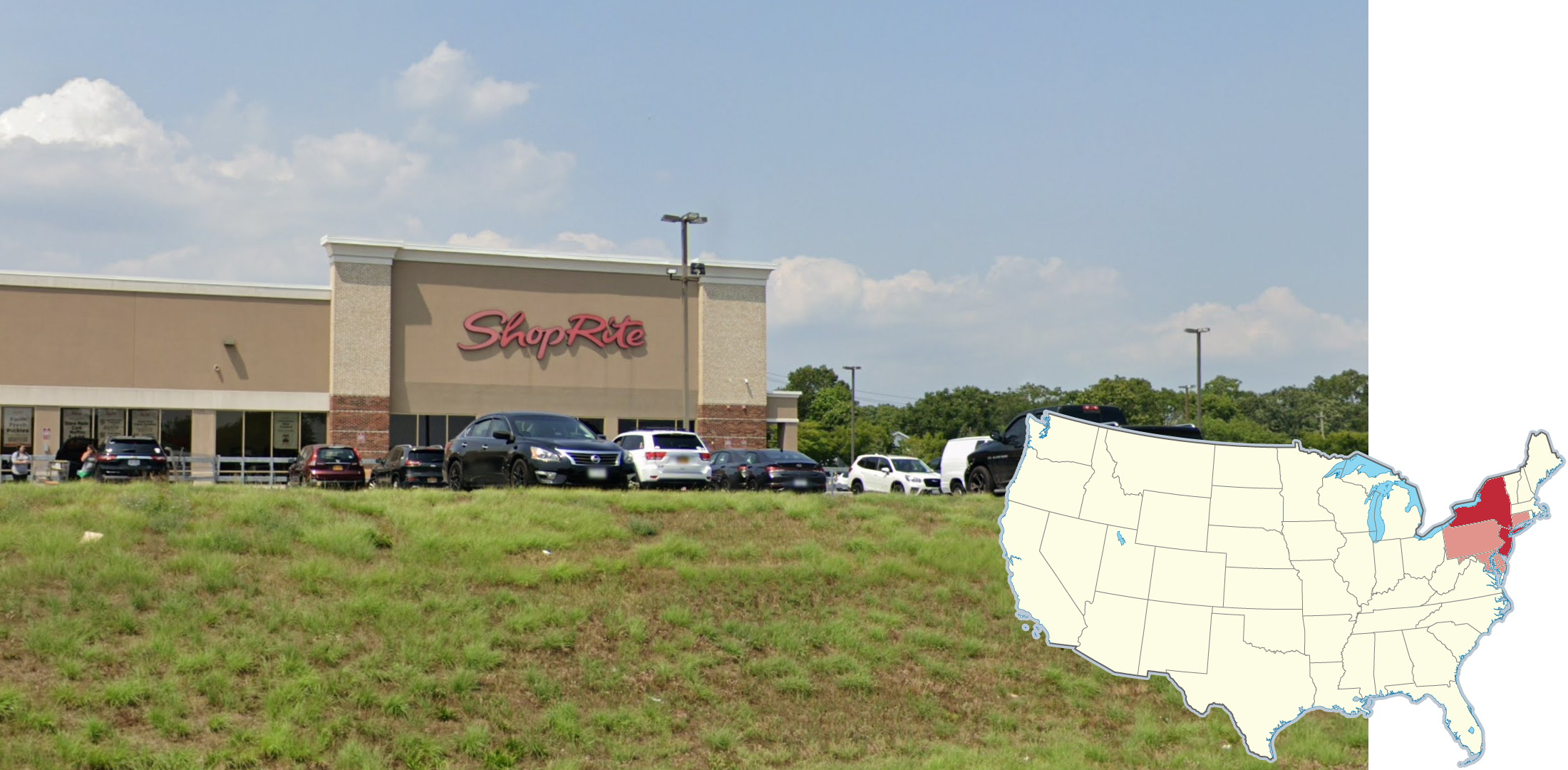
‘Shoprite’ is a regional supermarket chain that has locations in 6 states in the Northeast and Mid-Atlantic region of the US; Connecticut, New York, New Jersey, Pennsylvania, Delaware, and Maryland.
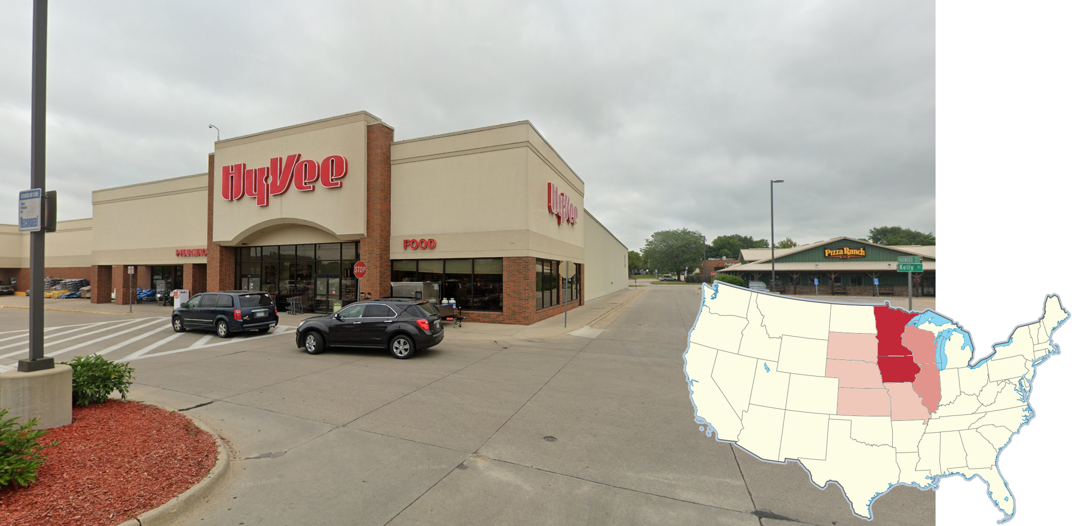
‘Hy-Vee’ is a supermarket that is common primarily in the Upper Midwest states of Iowa, Minnesota, Wisconsin, and Illinois.
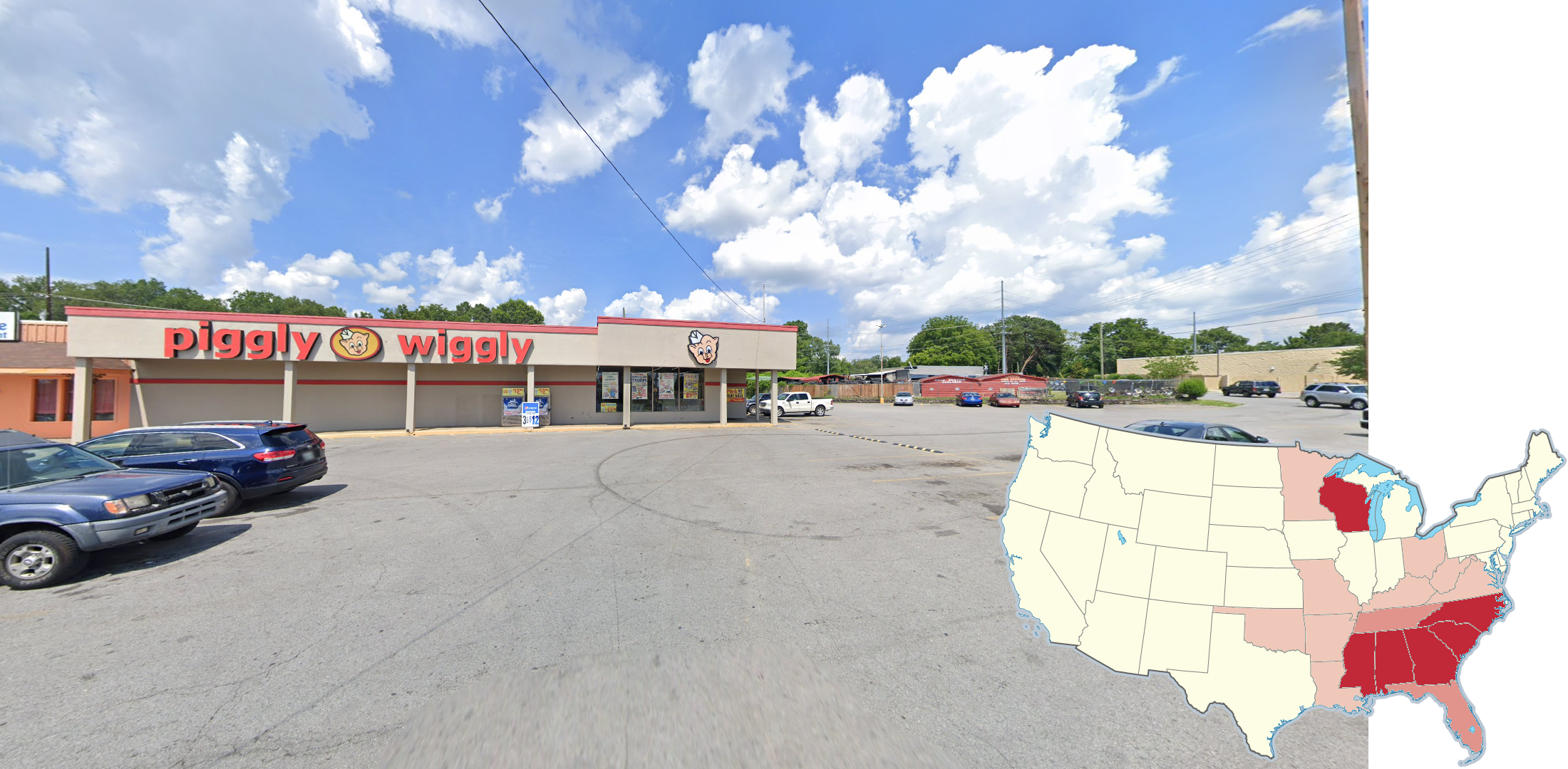
The supermarket chain ‘Piggly Wiggly’ is found mostly in the Southeast, as well as the state of Wisconsin.
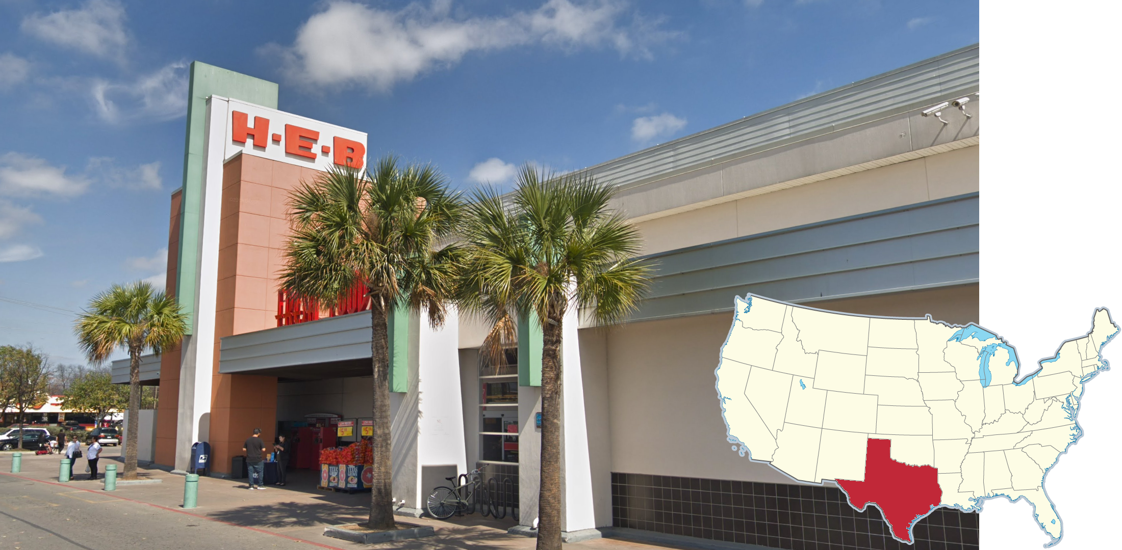
‘H-E-B’ is a supermarket that is only located in the state of Texas. Most H-E-B stores are in large cities.
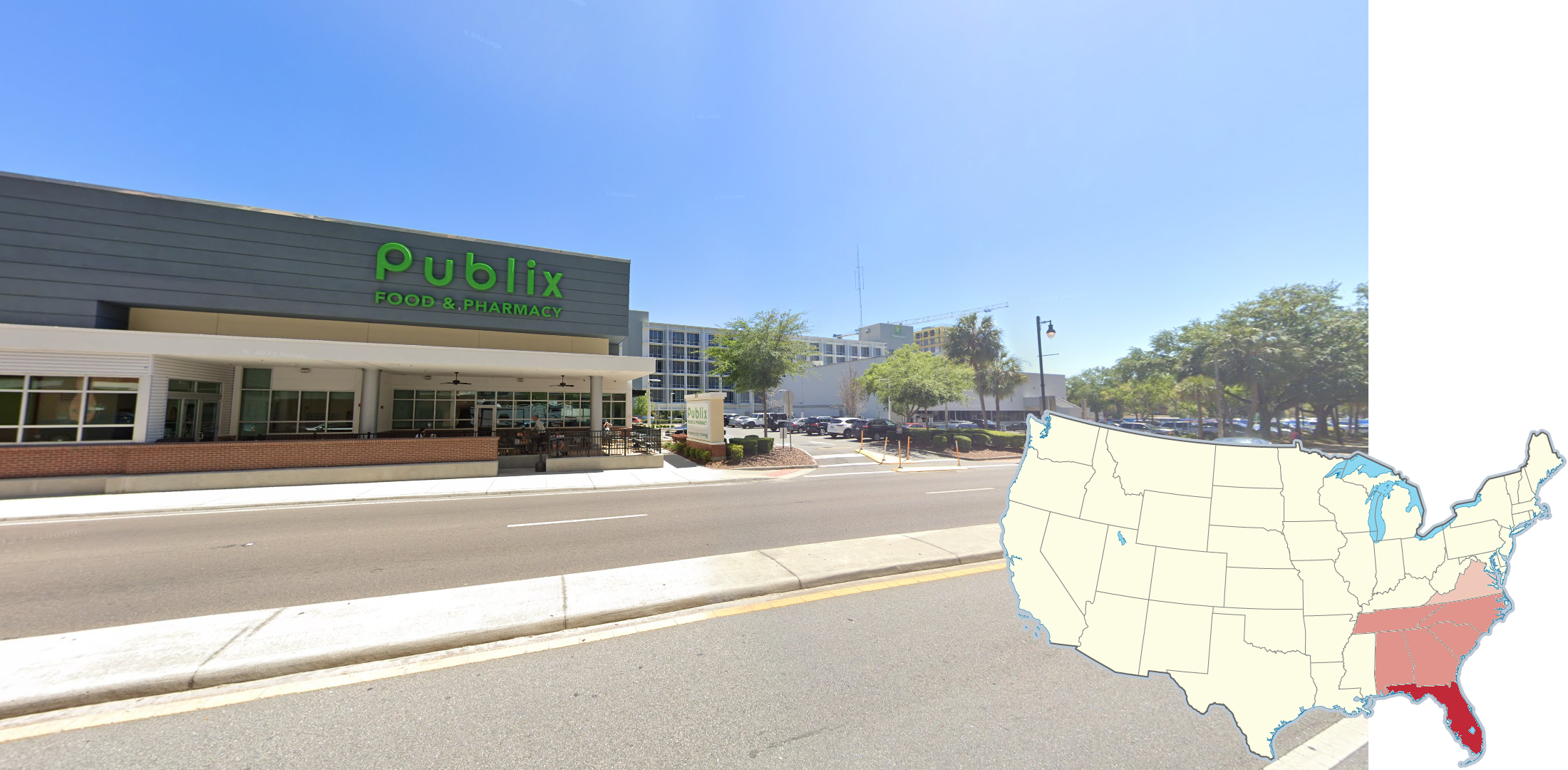
‘Publix’ is a regional supermarket chain that has locations primarily in Florida and adjacent areas of the Deep South.
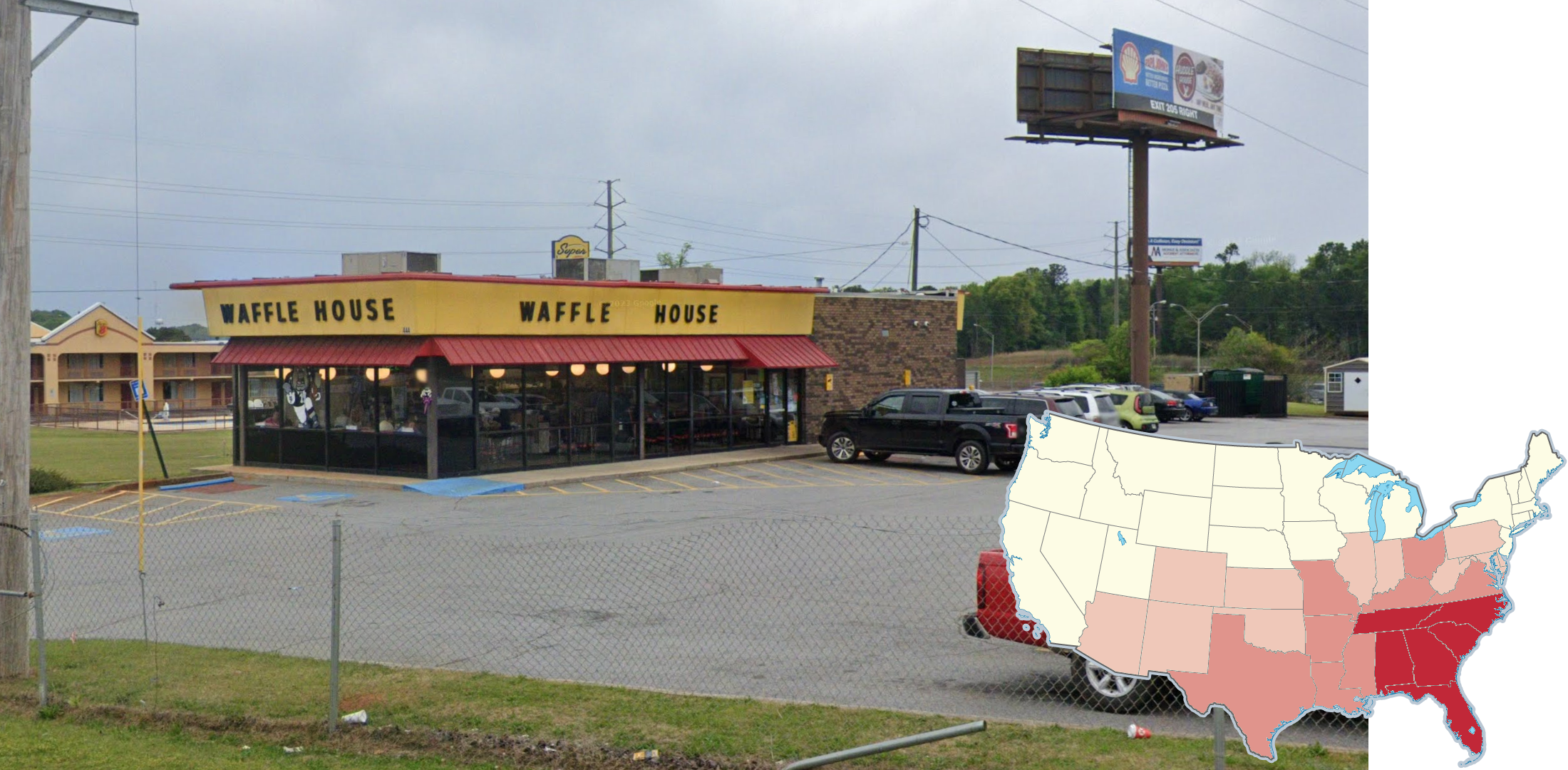
The restaurant chain ‘Waffle House’ is a regional chain that is primarily found in the Southern and Southeast US. Some midwest and mid-atlantic states have some locations. Georgia, by far, is the state with the most Waffle House locations.
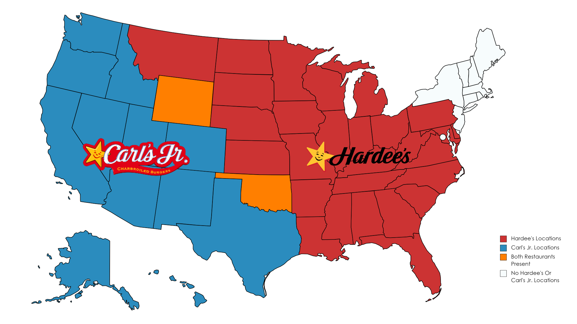
‘Carl’s Jr.’ and ‘Hardee’s’ are fast food restaurants that are operated by the same company and have a similar logo and colour scheme. However, Carl’s Jr. locations are all located on the West Coast and Southwest US, while Hardee’s are found in the central and Eastern areas of the country. Two states, Wyoming and Oklahoma, have both kinds of restaurants present.
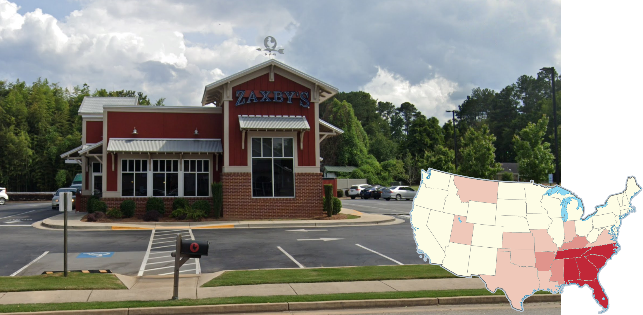
‘Zaxby’s,’ a fast-food chicken chain, is another restaurant that is most common in the Southeast US. There are several pockets outside the Southeast that have locations, such as Utah and Montana. Like Waffle House, Georgia has the highest number of locations.
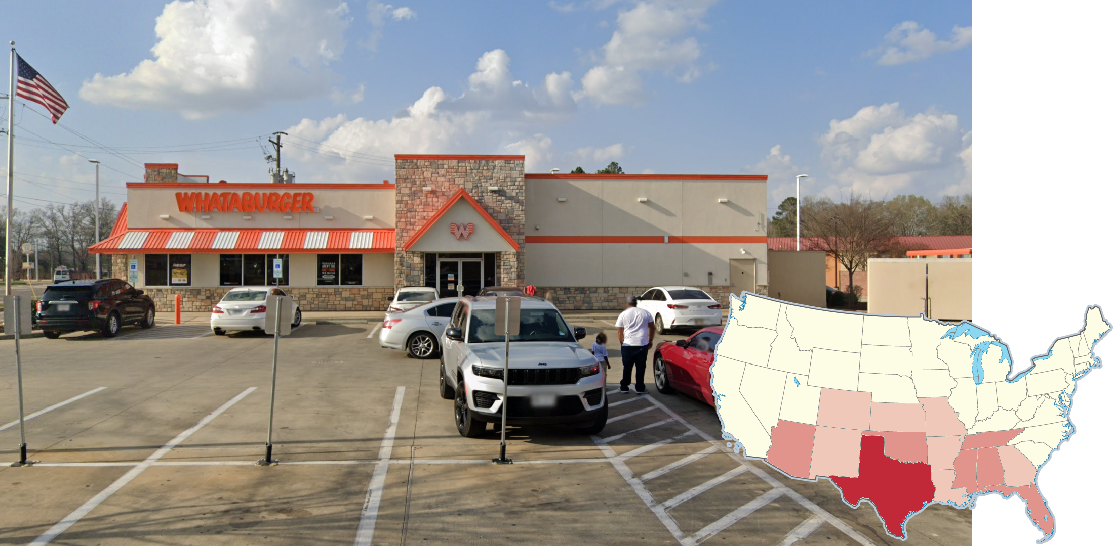
‘Whataburger’ is a hamburger restaurant with locations across the South Central US. The State that is home to the most locations, by far, is Texas.
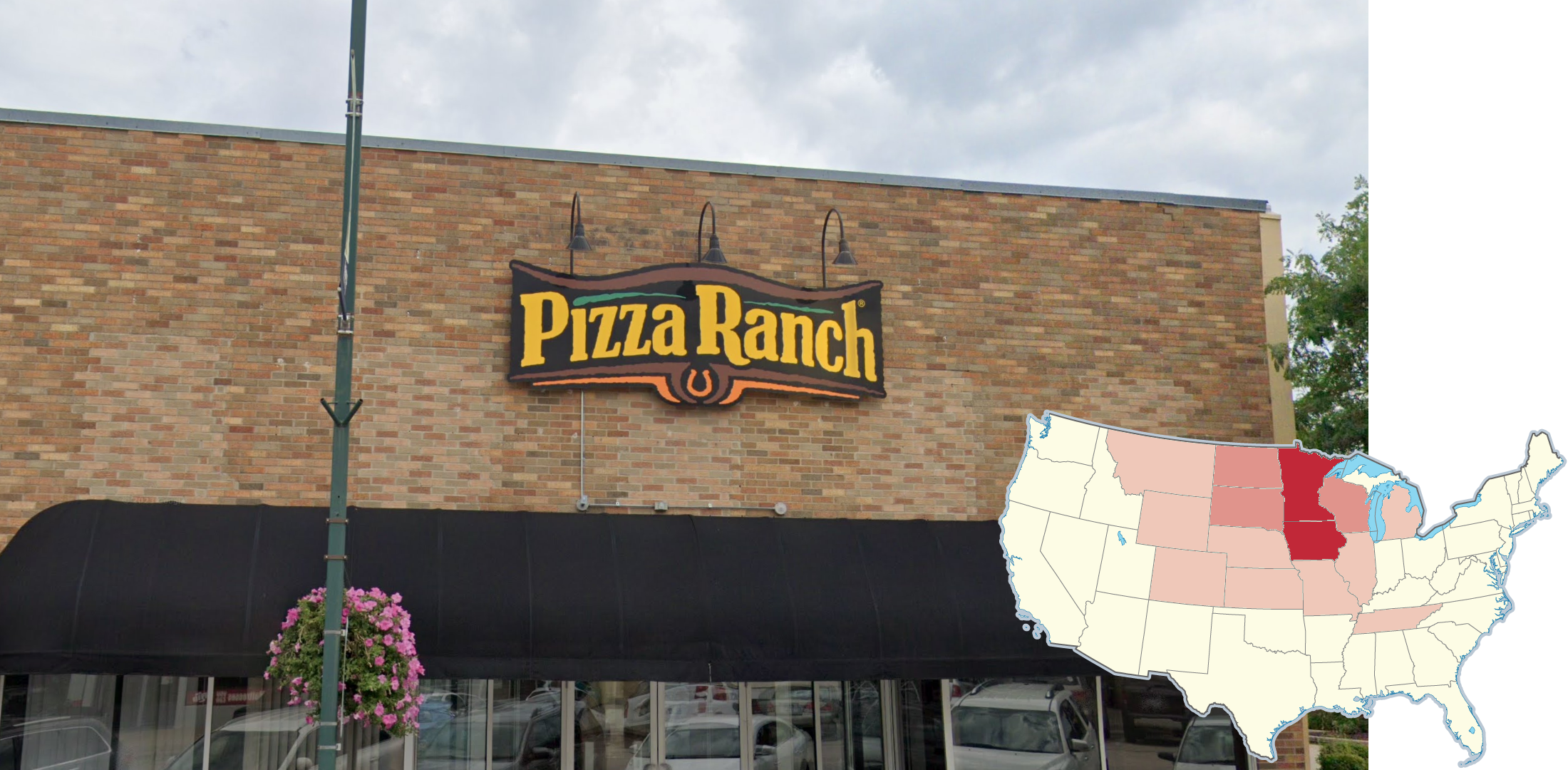
‘Pizza Ranch’ is a restaurant chain that is found in the middle of the country. Iowa and Minnesota have the highest number of locations.
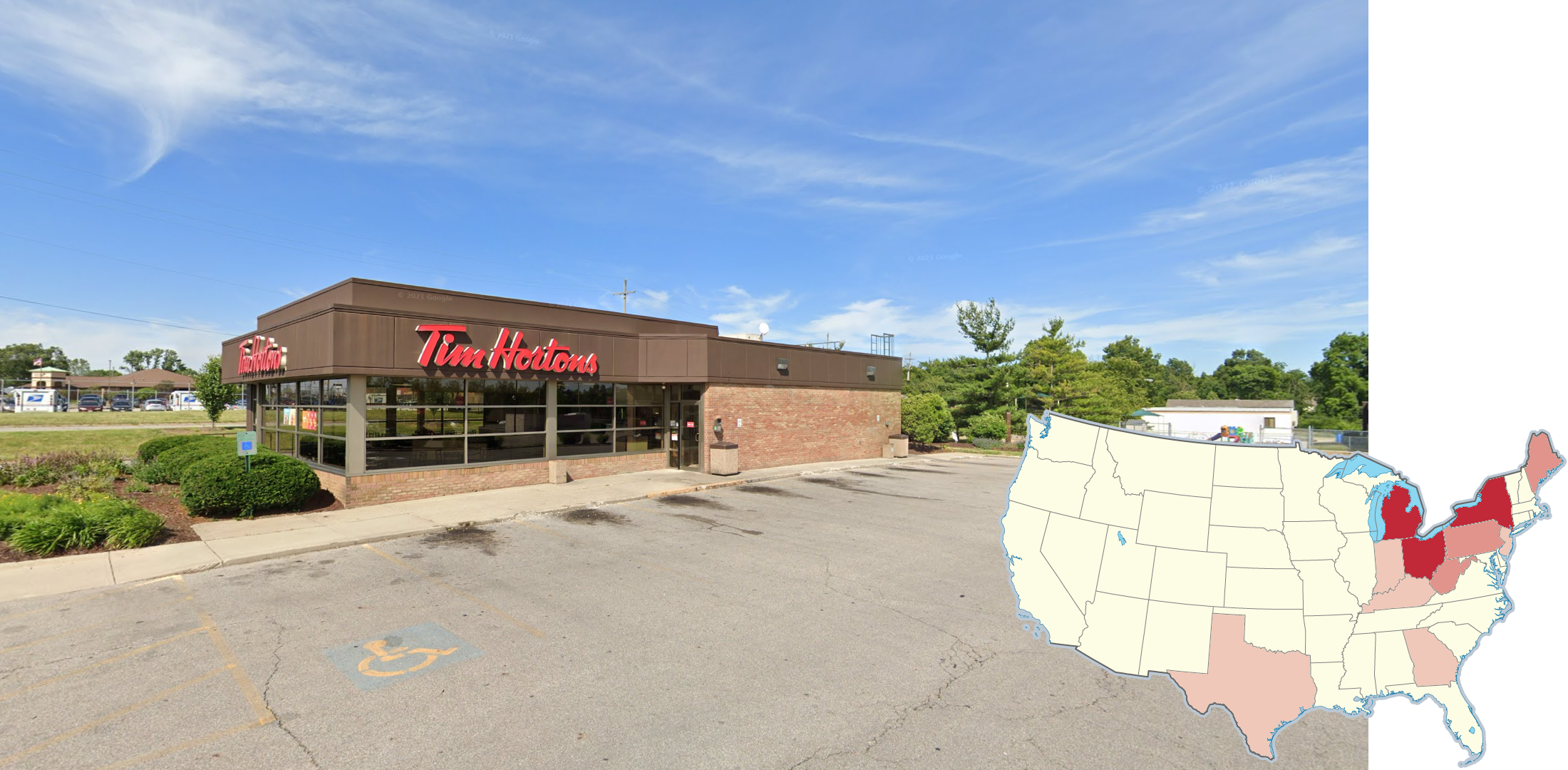
‘Tim Hortons’ is known for being the most popular restaurant chain in Canada. However, there are also many locations in the United States. They are primarily located in states adjacent to the Canadian Provinces of Ontario and Quebec, with a few locations also in Texas and Georgia.
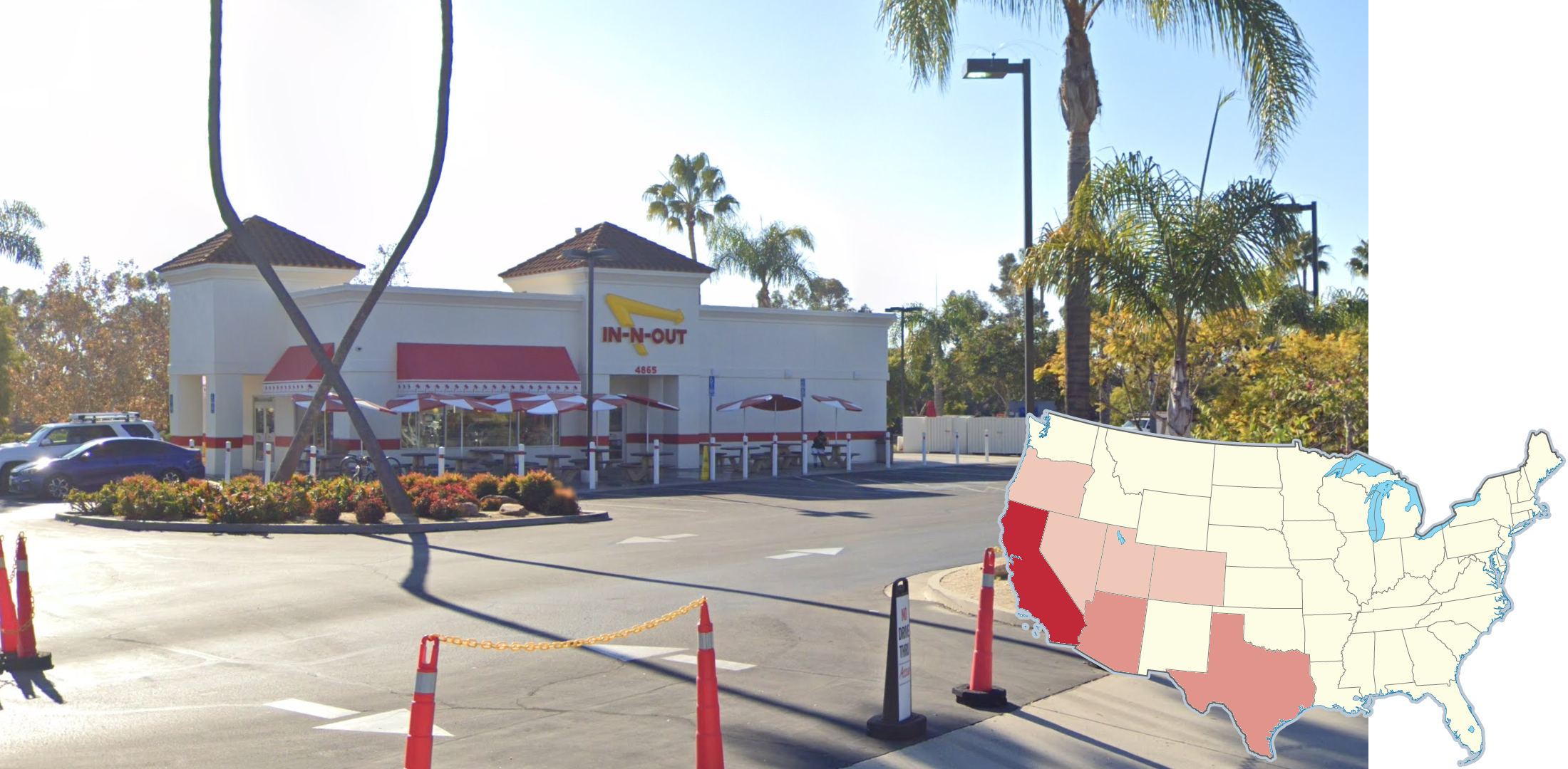
‘In-N-Out Burger’ is a regional fast food chain located primarily in the Southwest US. California has the most locations.
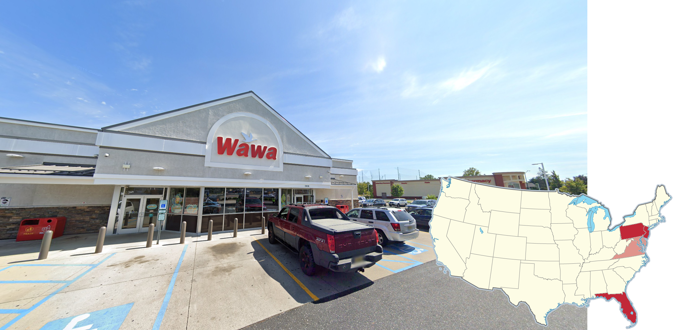
‘WaWa’ is a regional gas station and convenience store chain with locations in the Mid-Atlantic states and Florida. New Jersey and the Philadelphia, Pennsylvania area have the highest density of locations.
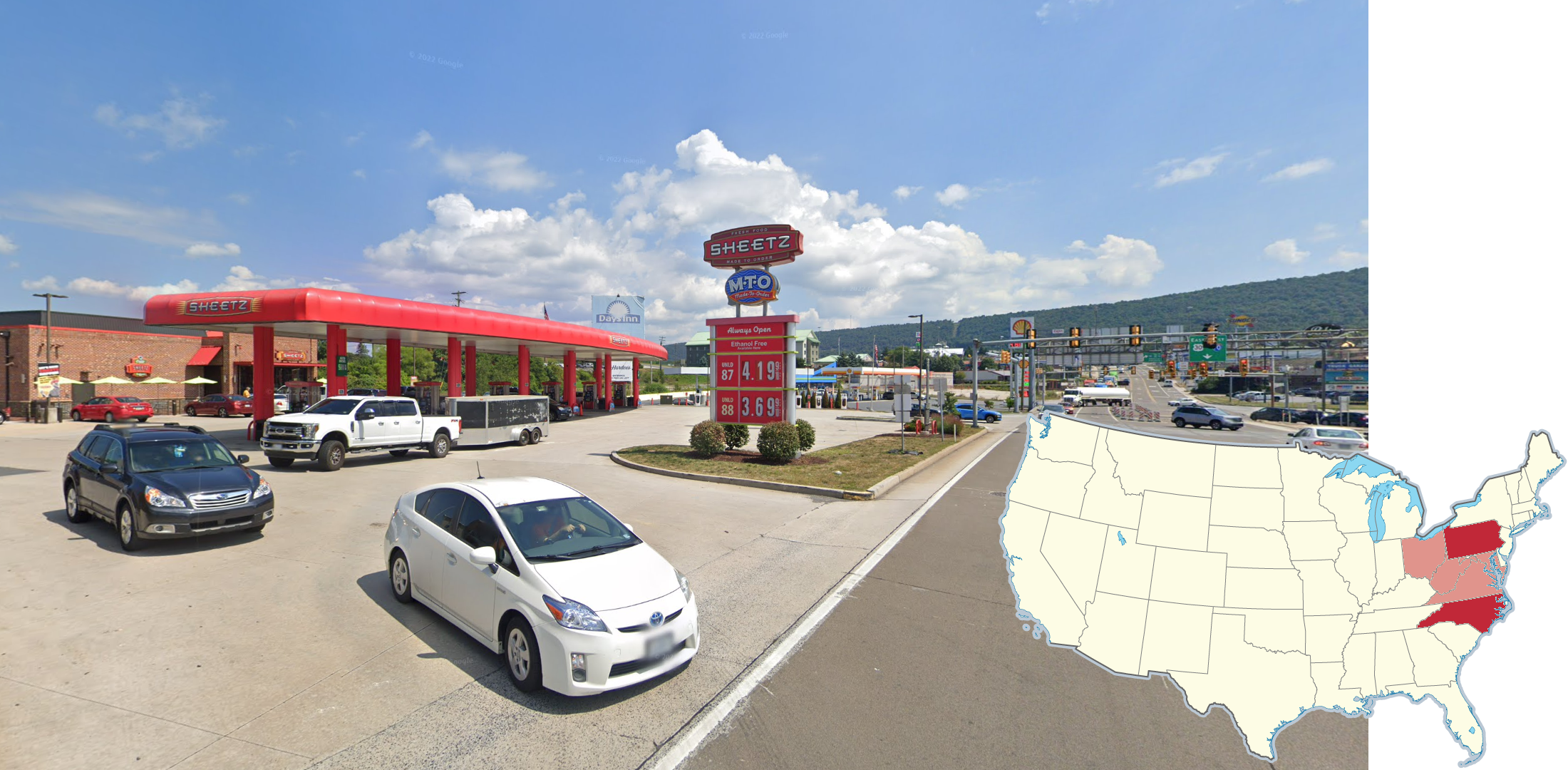
Another regional gas station and convenience store chain in the Eastern US is called ‘Sheetz’. Most of their locations are in the Mid-Atlantic and Central Appalachian areas of the US. Pennsylvania has the highest number of locations.
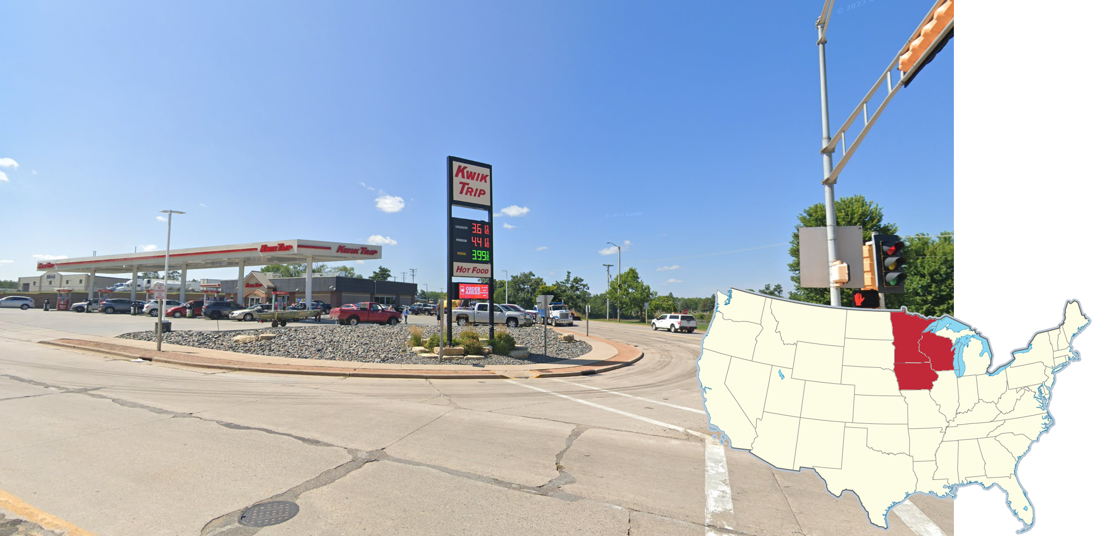
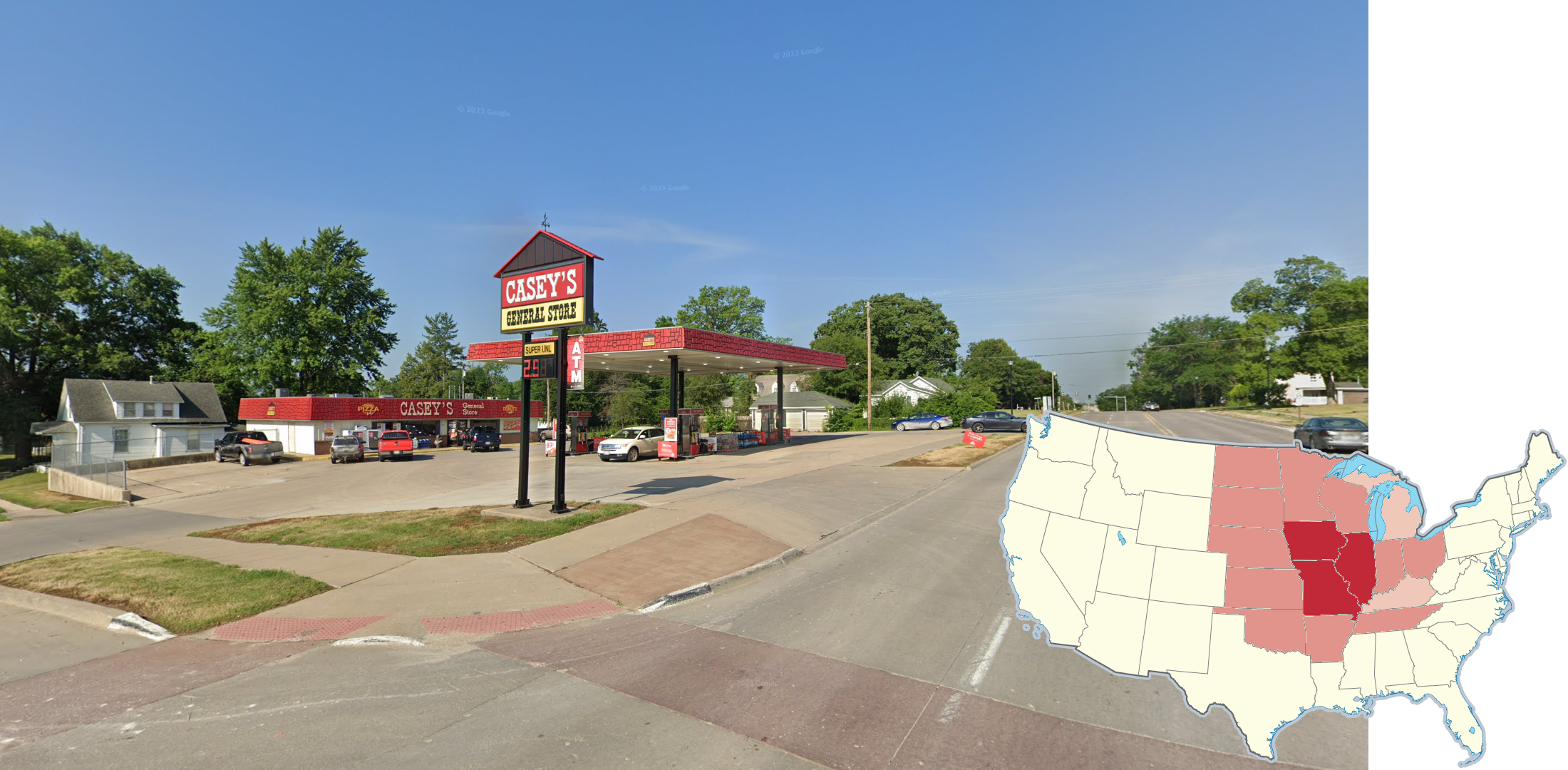
‘Casey’s’ is a popular gas station and convenience store chain that is found in the Midwest, Plains, and parts of the Mid-South. Illinois, Iowa, and Missouri have the highest number of locations.
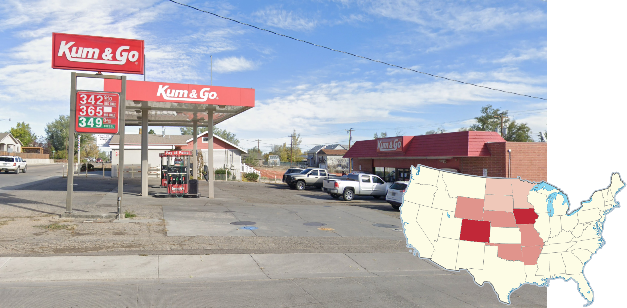
‘Kum & Go’ is a regional gas station chain based out of the state of Iowa. They also have pockets of locations in the Ozarks, Colorado, Wyoming, and North Dakota.
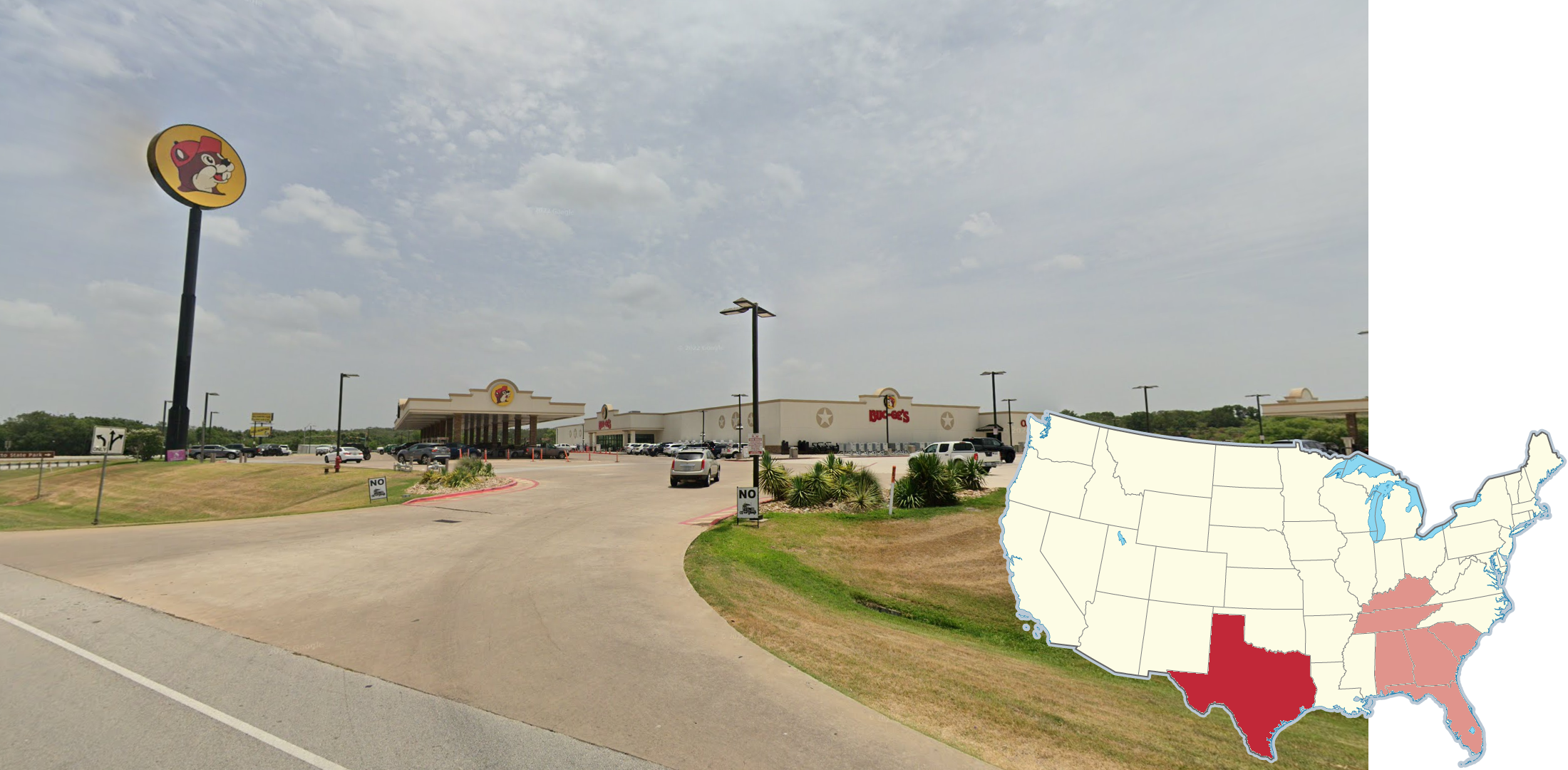
‘Buc-ee’s’ is a small chain of oversized gas stations located primarily in the state of Texas. These stores feature multiple rows of gas pumps, and a very large convenience store building.
NOTE: Some other nearby states have Buc-ee’s locations, but they are quite rare outside of Texas.
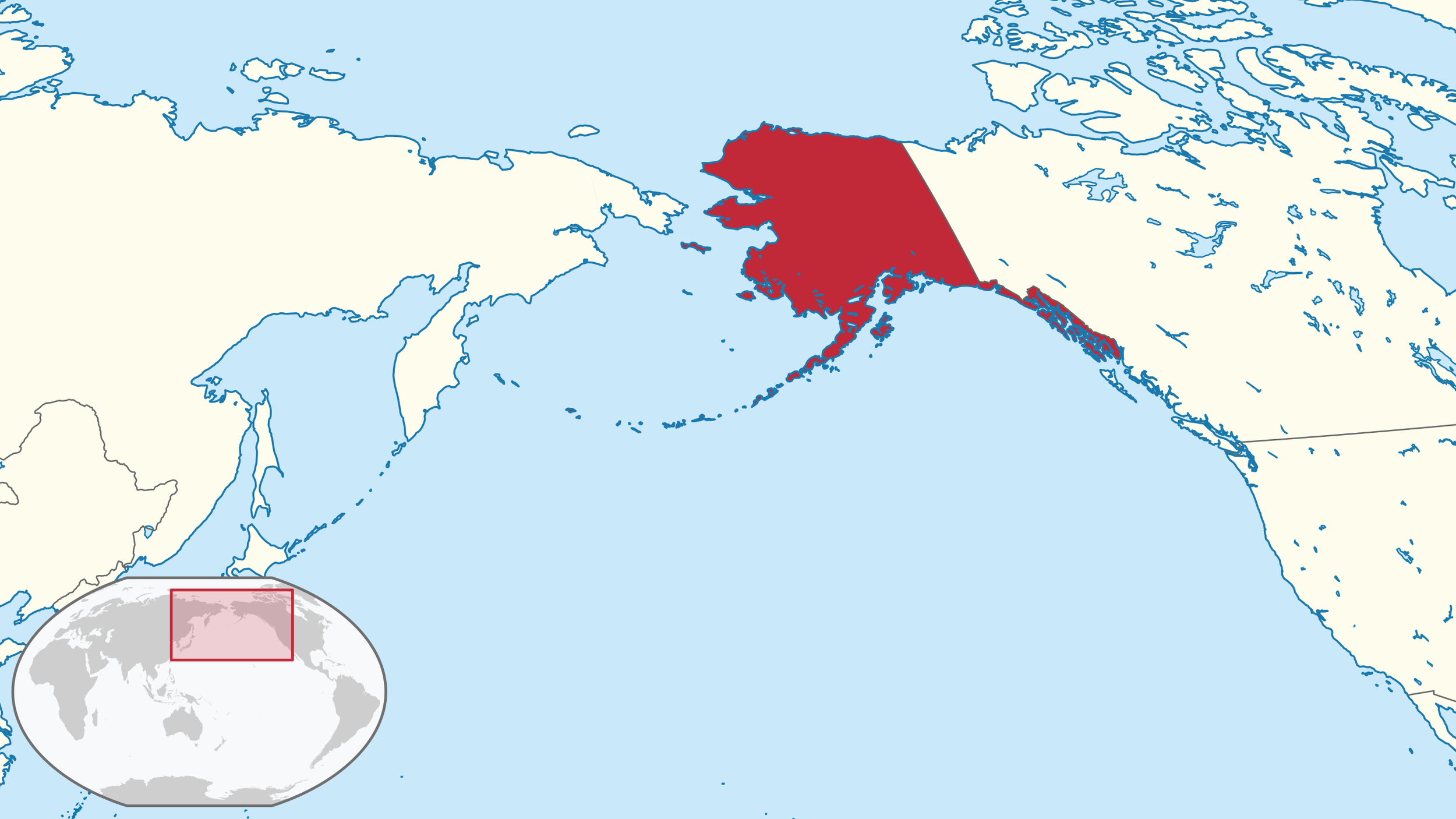
Alaska is the largest state and the north-, west-, and easternmost state in the US.
A separate Plonk It guide to Alaska can be found here.
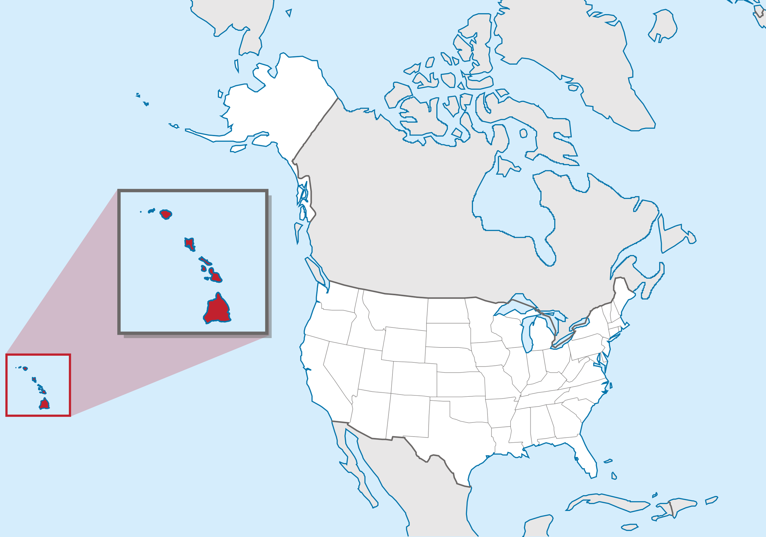
Hawaii is the youngest state in the US and the only US state outside of North America.
A separate Plonk It guide to Hawaii can be found here.
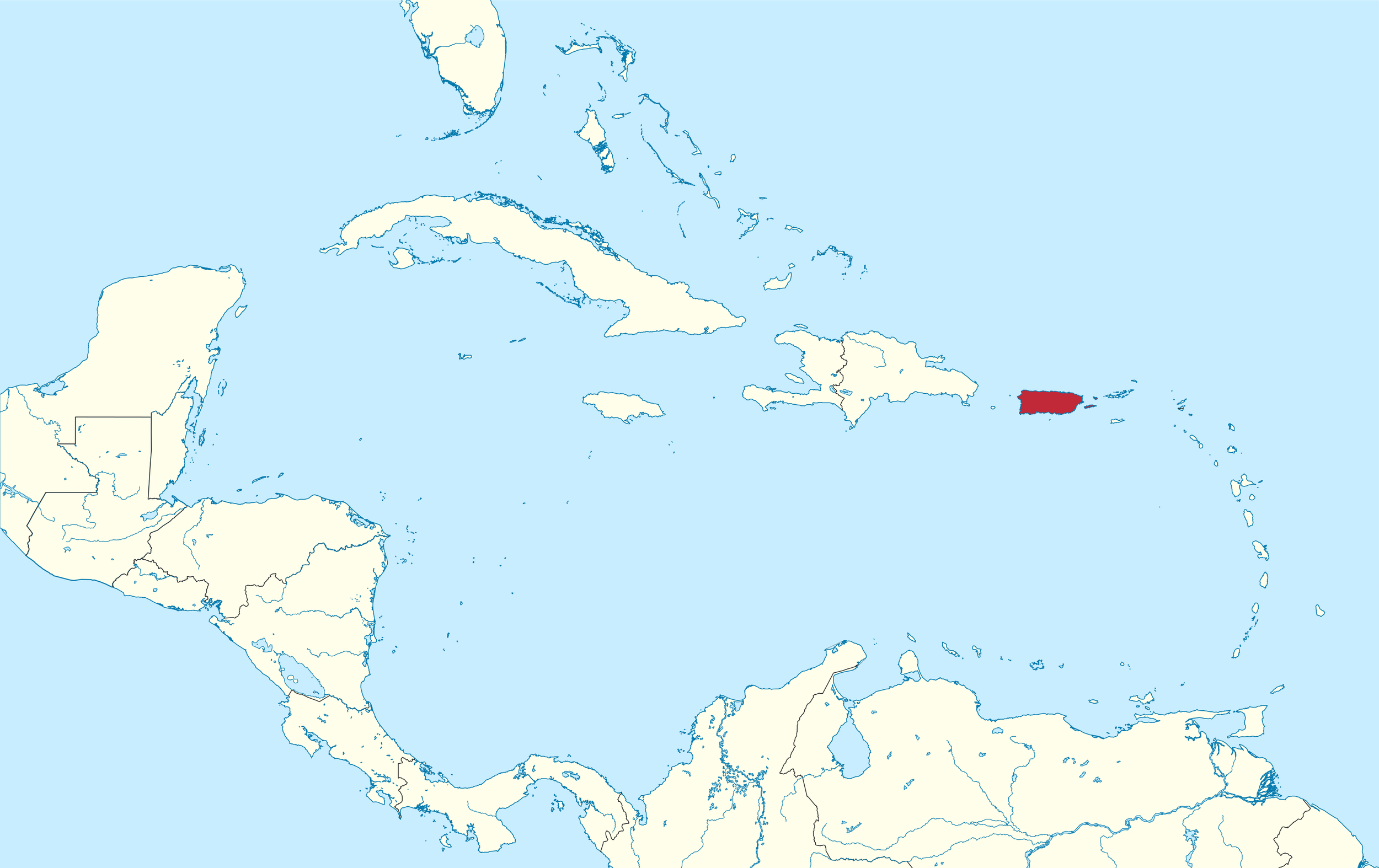
Puerto Rico is a Caribbean US territory with official Commonwealth status.
A separate Plonk It guide to Puerto Rico can be found here.
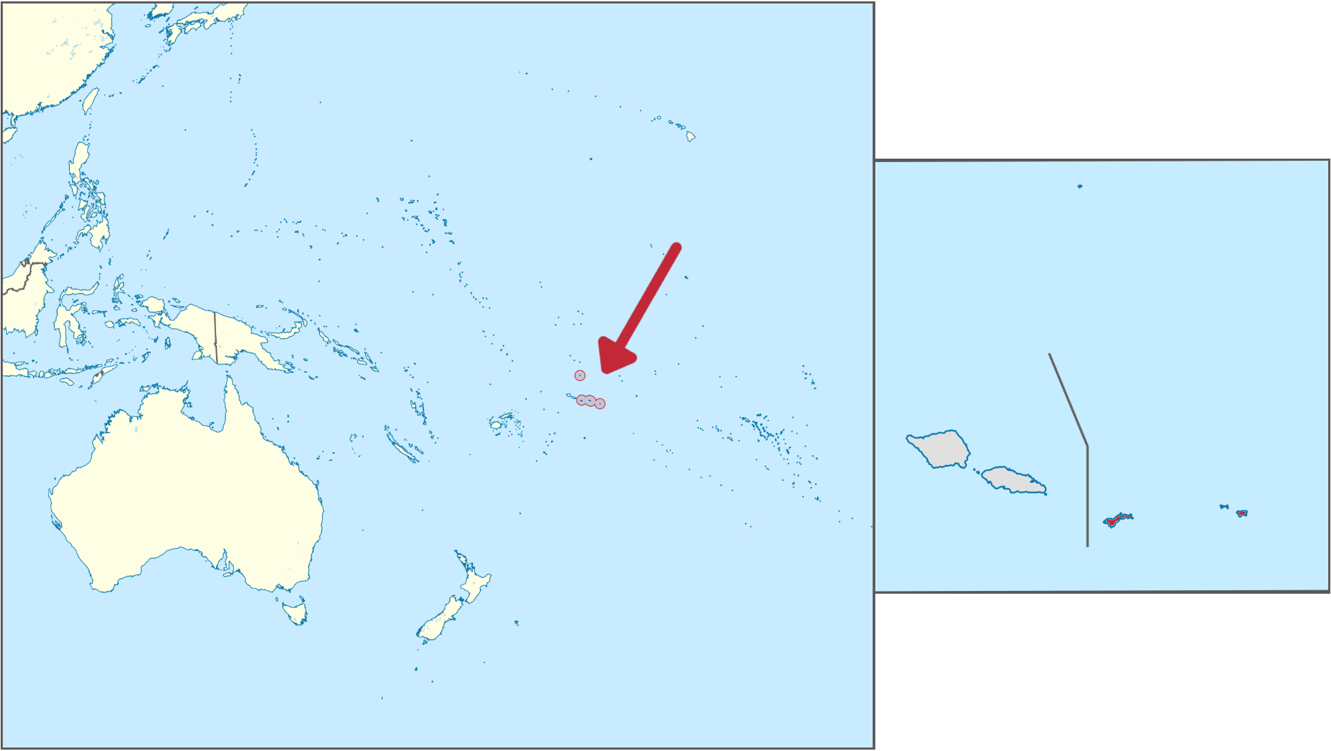
American Samoa is a South Pacific island group and an unorganised US territory.
A separate Plonk It guide to American Samoa can be found here.
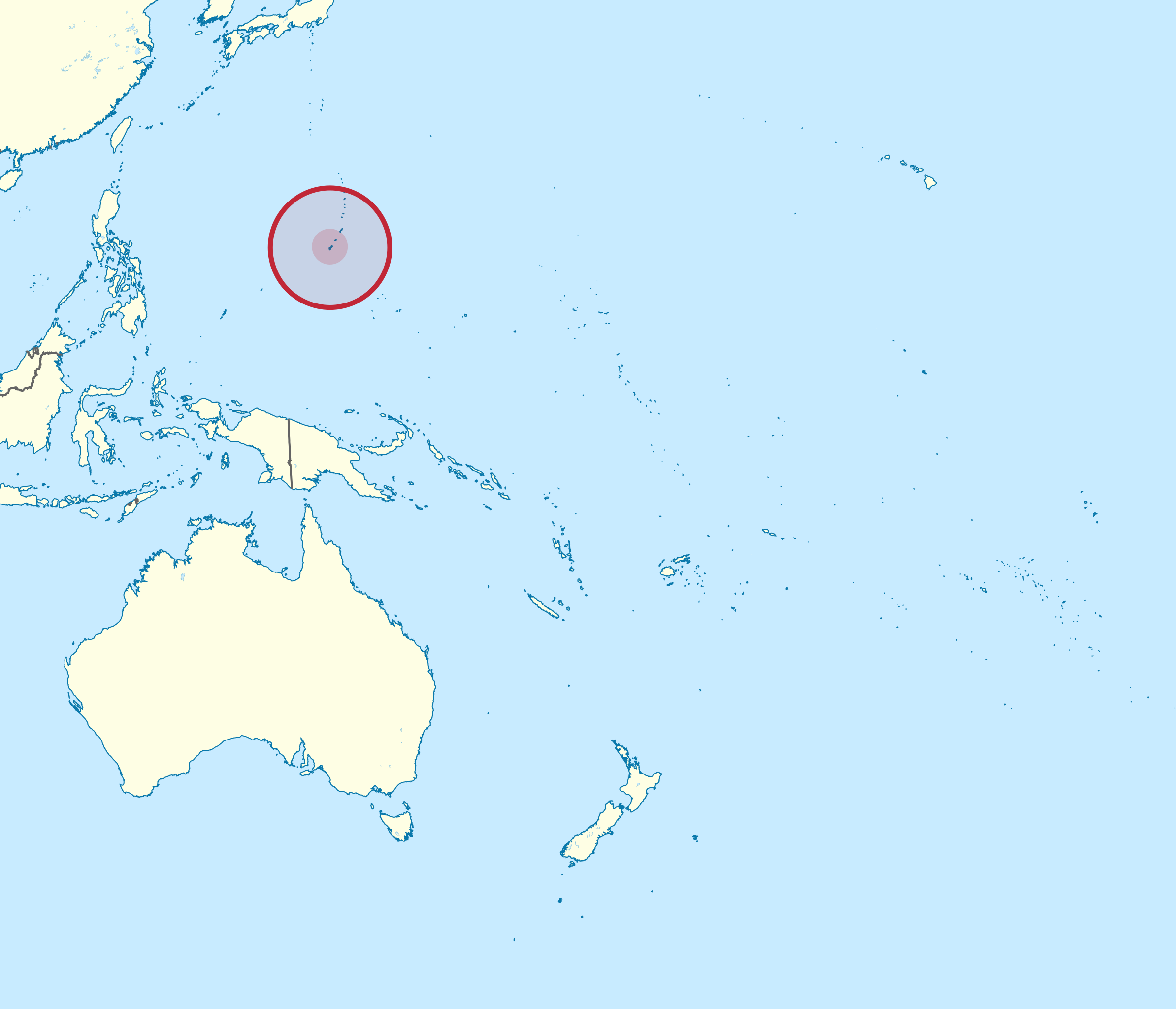
Guam is an unincorporated territory of the US and the largest island in Micronesia.
A separate Plonk It guide to Guam can be found here.
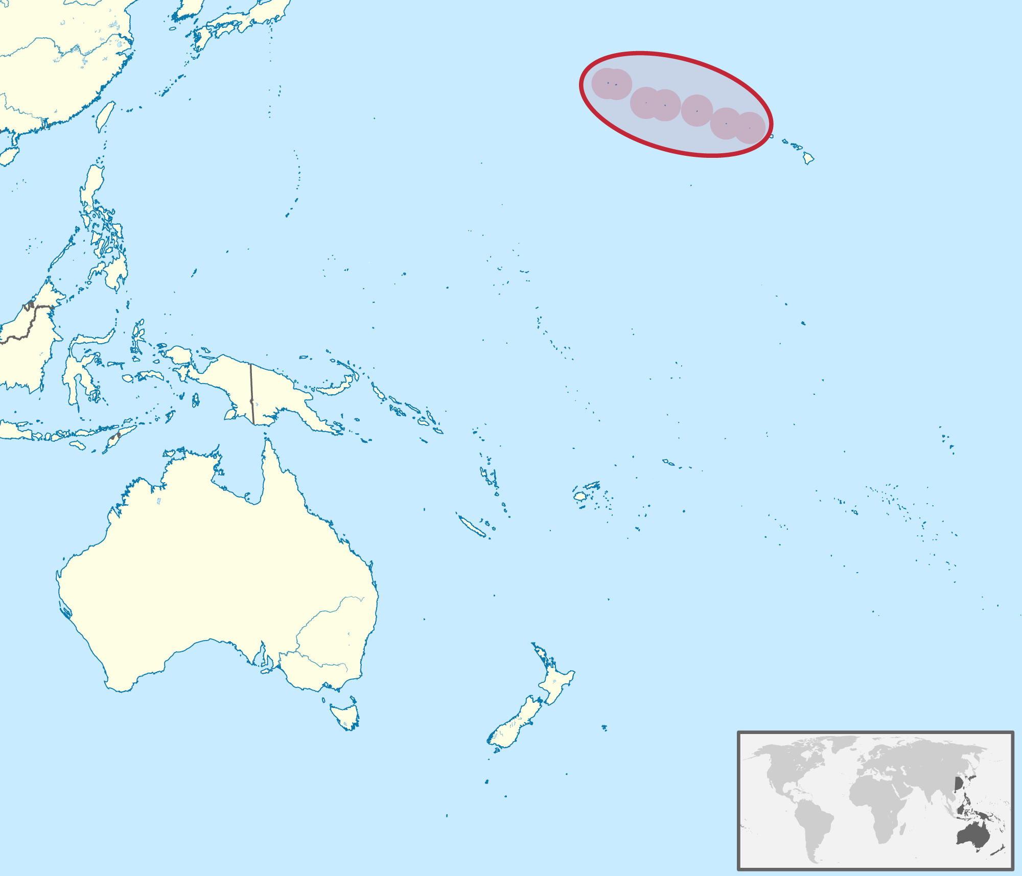
Northern Mariana Islands is a Northwest Pacific island chain and a Commonwealth US territory.
A separate Plonk It guide to Northern Mariana Islands can be found here.
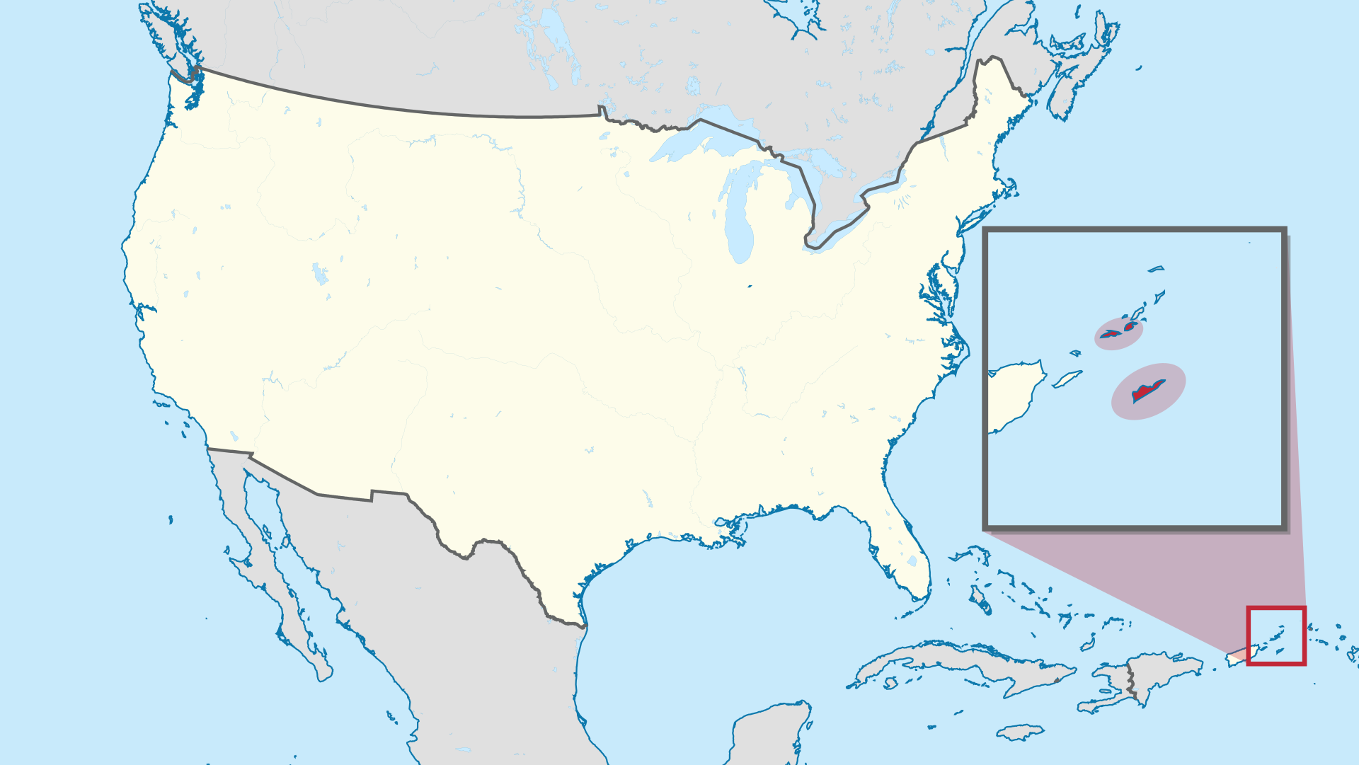
The United States Virgin Islands is a Caribbean US territory and the only area of the US that drives on the left side of the road.
A separate Plonk It guide to the United States Virgin Islands can be found here.
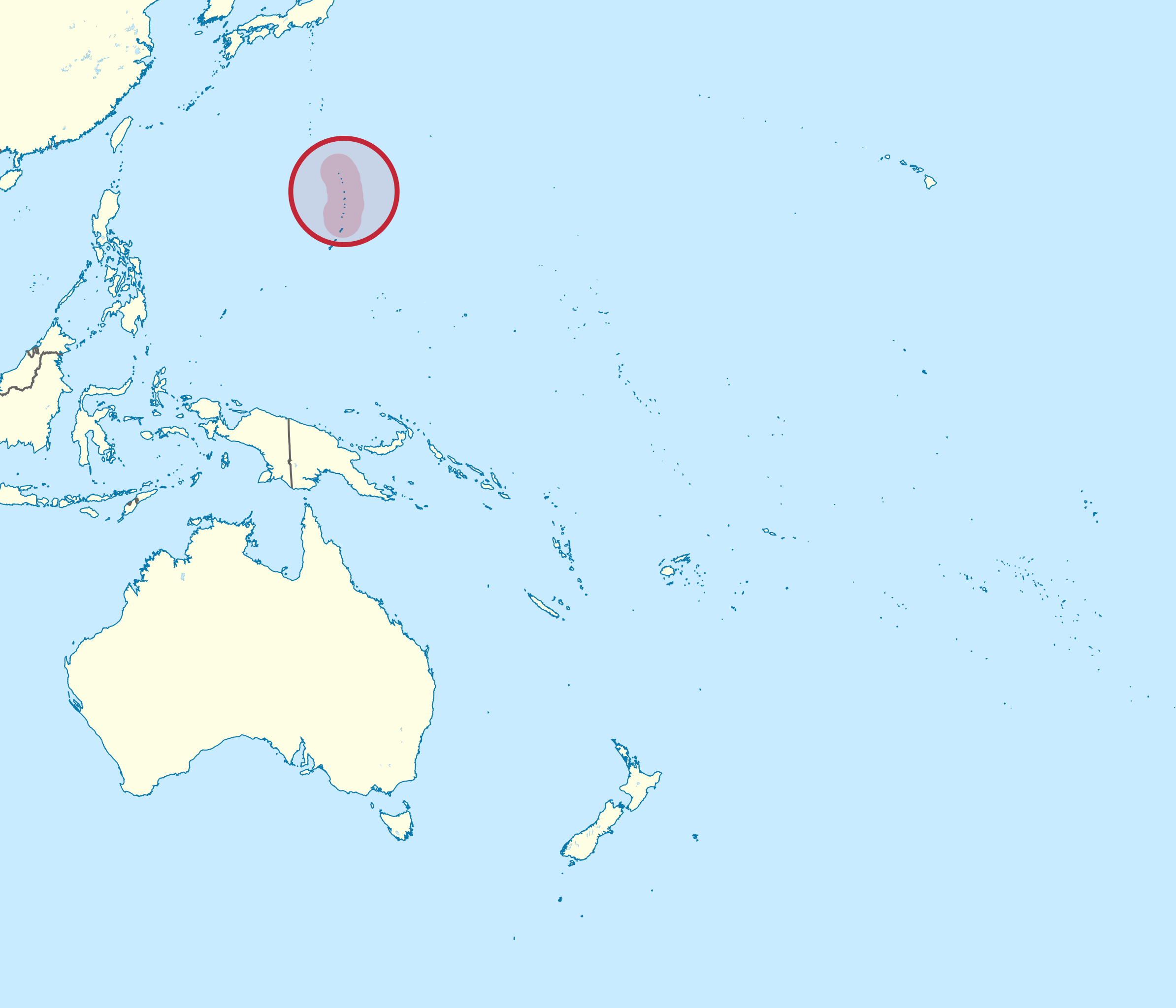
The US Minor Outlying Islands is a collective name for several small island US territories, with the Midway Atoll being the most relevant in Geoguessr.
A separate Plonk It guide to the US Minor Outlying Islands can be found here.
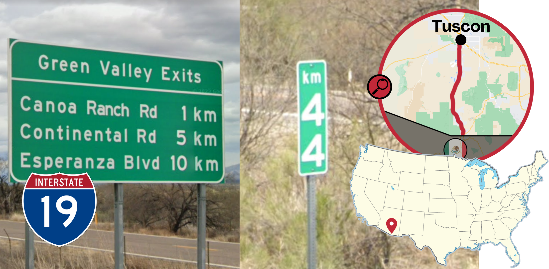
Interstate 19 in Arizona from Tucson to the Mexico border uses kilometres on the exit and distance signs. This is the only part of the country that uses kilometres instead of miles for highway signs.
NOTE: Speed limit signs in this area still use MPH instead of KPH
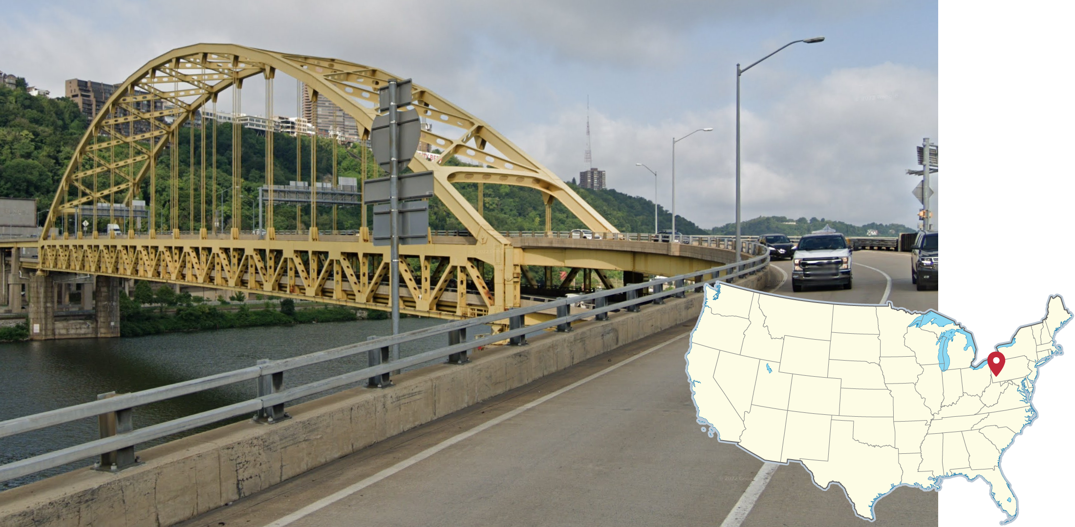
Many bridges are used to connect the various neighbourhoods of Pittsburgh, Pennsylvania. These expansive, steel bridges are commonly painted bright yellow. Additionally, Pittsburgh is easy to identify because of it being flanked by 3 rivers and steep bluffs on all sides.
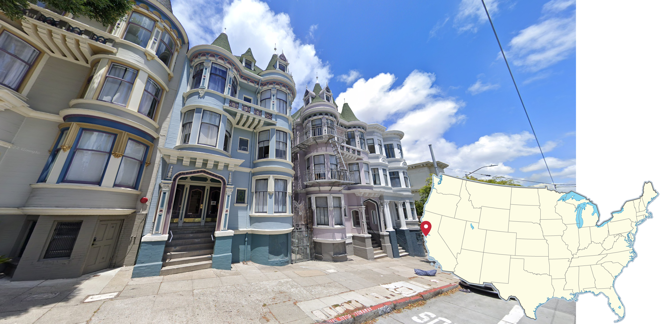
Row Houses and other buildings in San Francisco are often in the style of Victorian architecture, with many bay windows, turrets, and ornate exterior details. These homes are built close together and can be very colourful.

Neighbourhoods all around the city of New Orleans feature many colourful, historic, shotgun-style houses.
Buildings in central areas of New Orleans often feature colourful facades with second story wrap-around balconies.
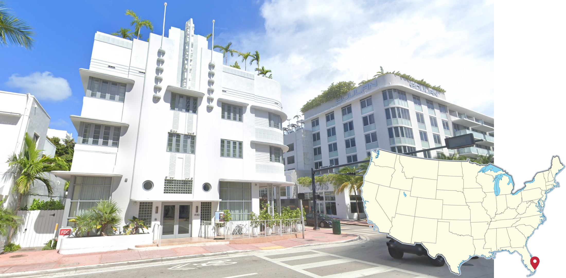
Historical areas of Miami and Miami beach are home to many historical, multi-story art deco buildings. These buildings are commonly painted in bright colours and are located near the coast.
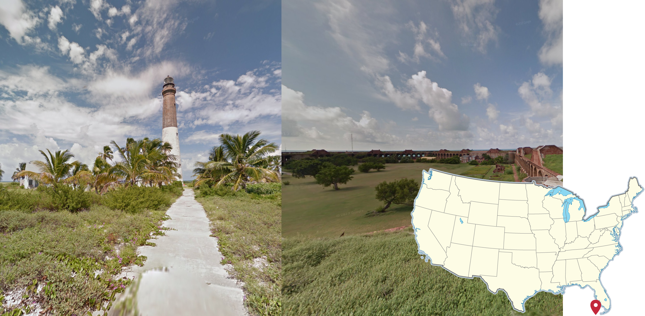
The main island of Dry Tortugas National Park, west of Key West, can be identified by the hexagonal brick structure and the surrounding moat.
The Loggerhead Lighthouse, situated on the Loggerhead Key, has a brown top-half and a white bottom. The path on which the trekker walks on is also made of bright concrete, and many palm trees can be seen around the lighthouse.
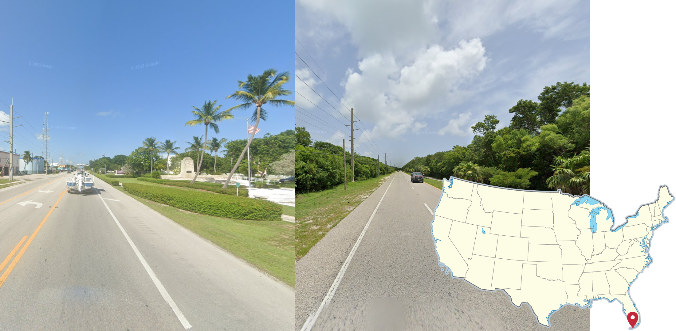
The Florida Keys are an archipelago of tropical islands west of Miami. The highway connecting the islands can be recognized by green, tropical vegetation on the sides of the usually single lane road. The soil is also sandy white.
Urban locations are also similar, but with many more planted palm trees and mowed grass being a common sight.
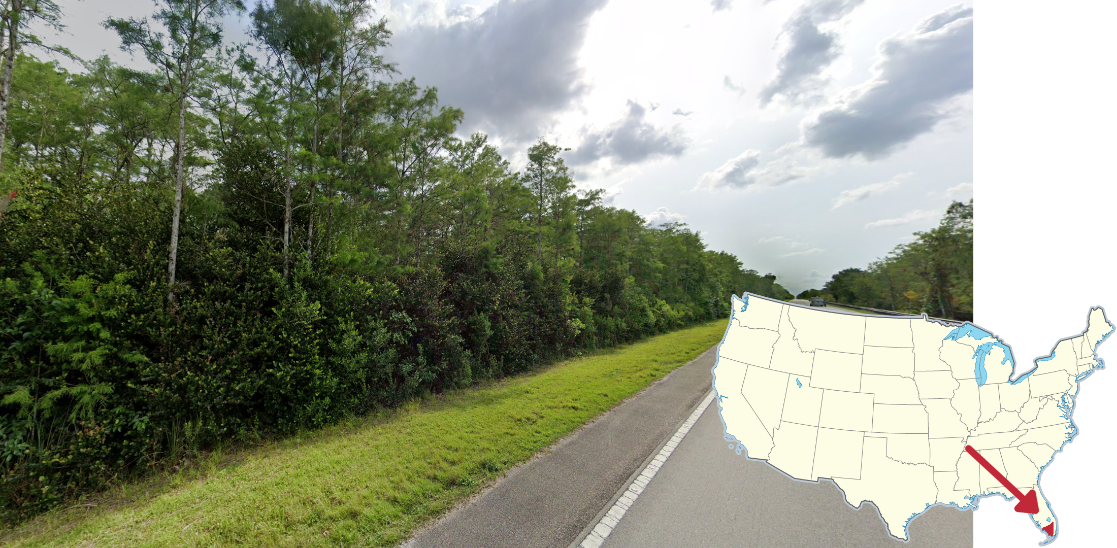
Deep South Florida, between the metropolitan areas of Ft. Myers and Miami, features dense, jungle-like forests that have few inhabitants. Roads through these areas are commonly very straight and long.

The area between the cities of Orlando and Lakeland in Florida sometimes feature low, rolling hills. Lakes and agricultural fields are also common in this area. This is the only main hilly area in central or southern Florida.
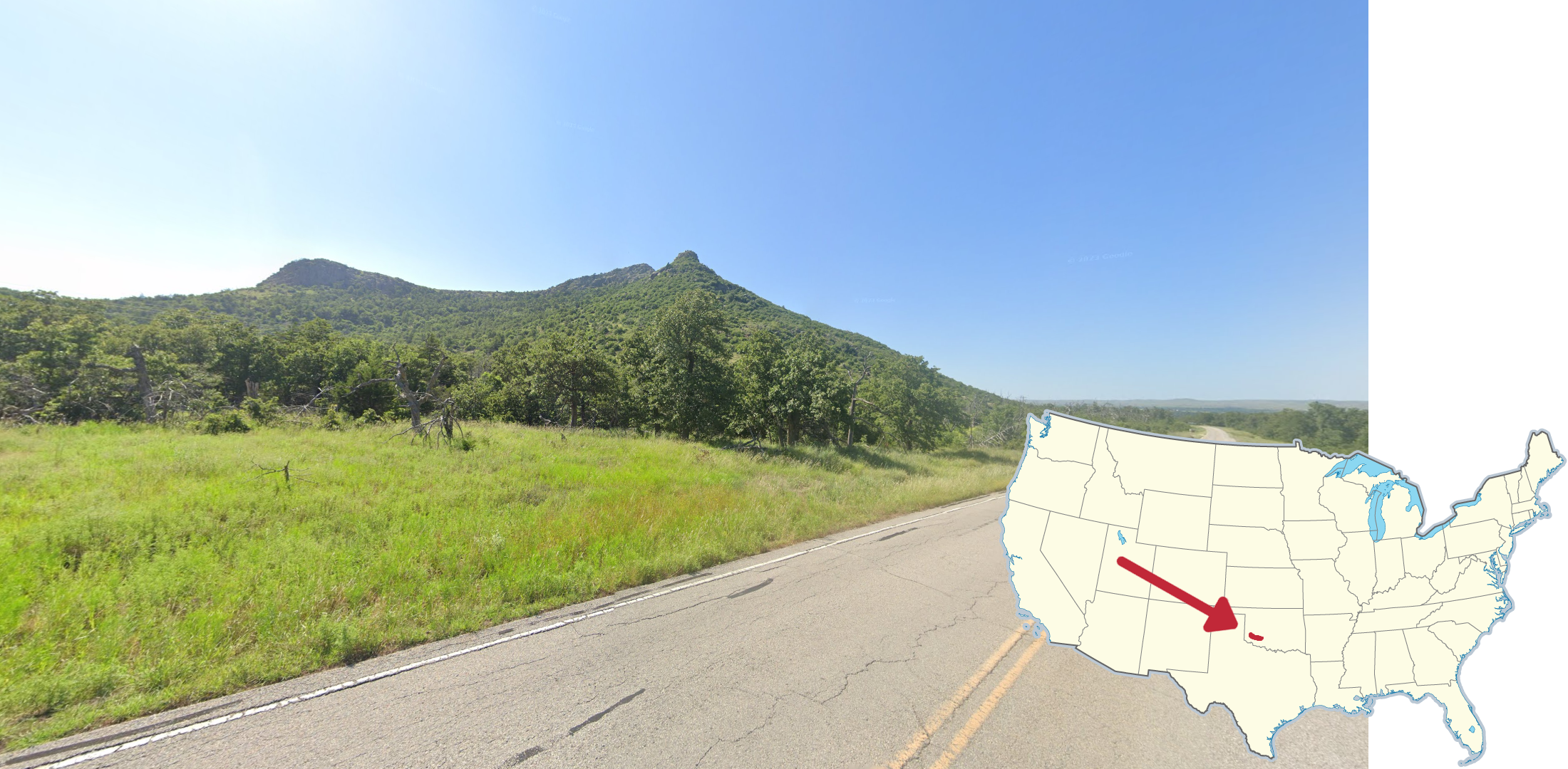
Southwestern Oklahoma features a small area of rocky, shrubby peaks. Some of the mountains are also covered in trees, and the rocks can have a pinkish red tint to them.
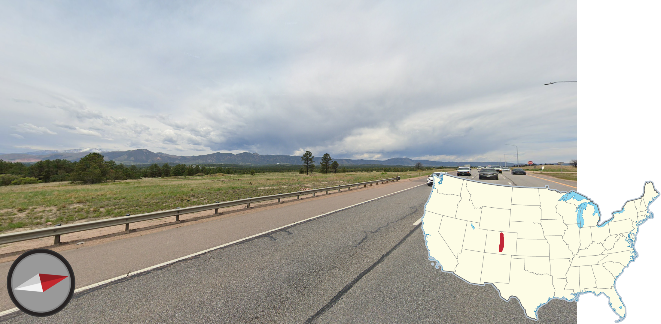
Central Colorado is home to a large North-to-South oriented mountain ridge. This divides the Rocky Mountains to the west and the Great Plains to the east.These mountains are adjacent to the major metropolitan areas of Boulder, Denver, and Colorado Springs.
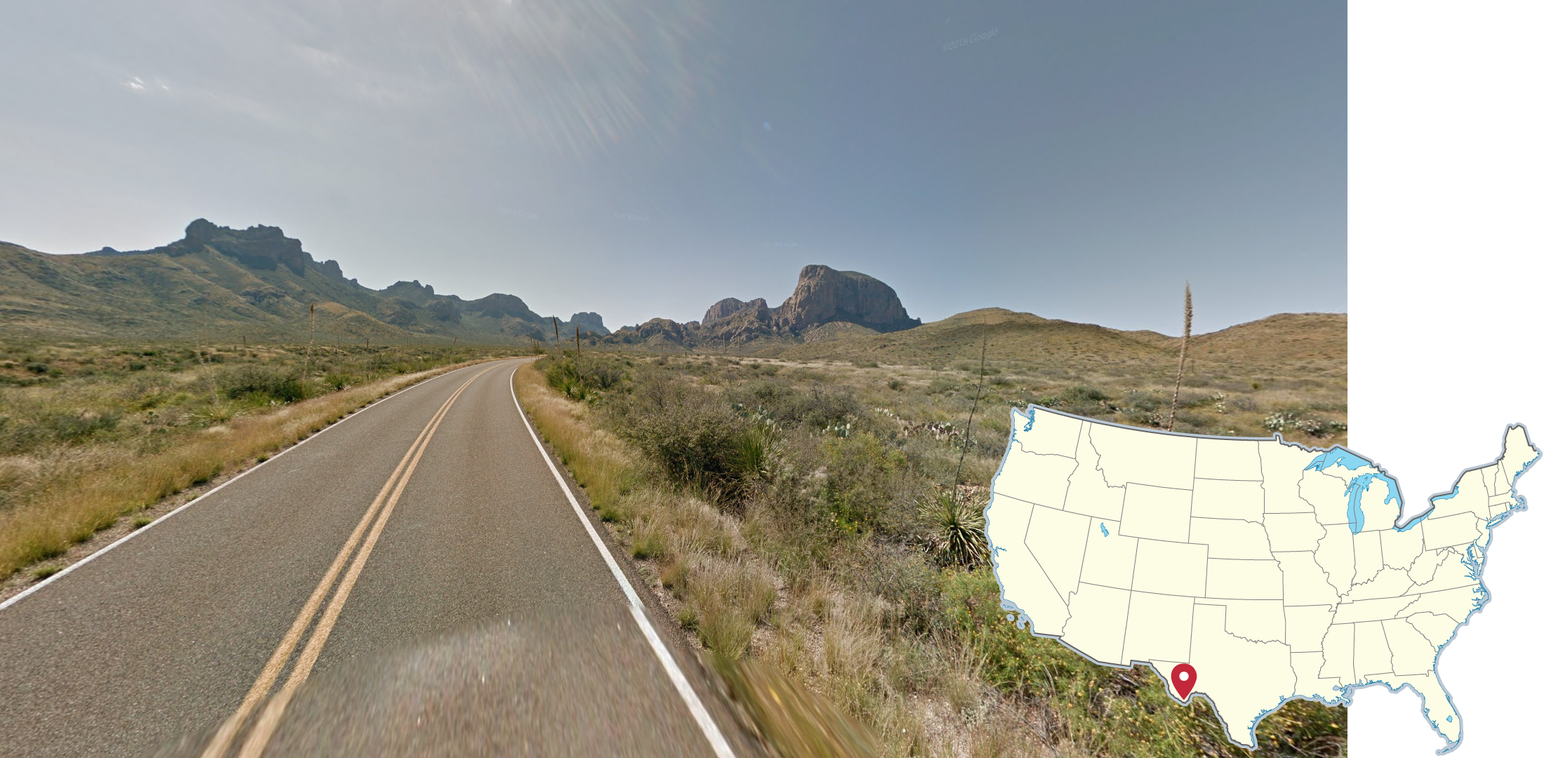
Big Bend National Park is located along the Mexico border in Southwest Texas. It can be identified by its dry, rocky peaks and shrubby foliage. This park is adjacent to the Chihauhan desert, so plants such as yucca and prickly pear cactus are common.
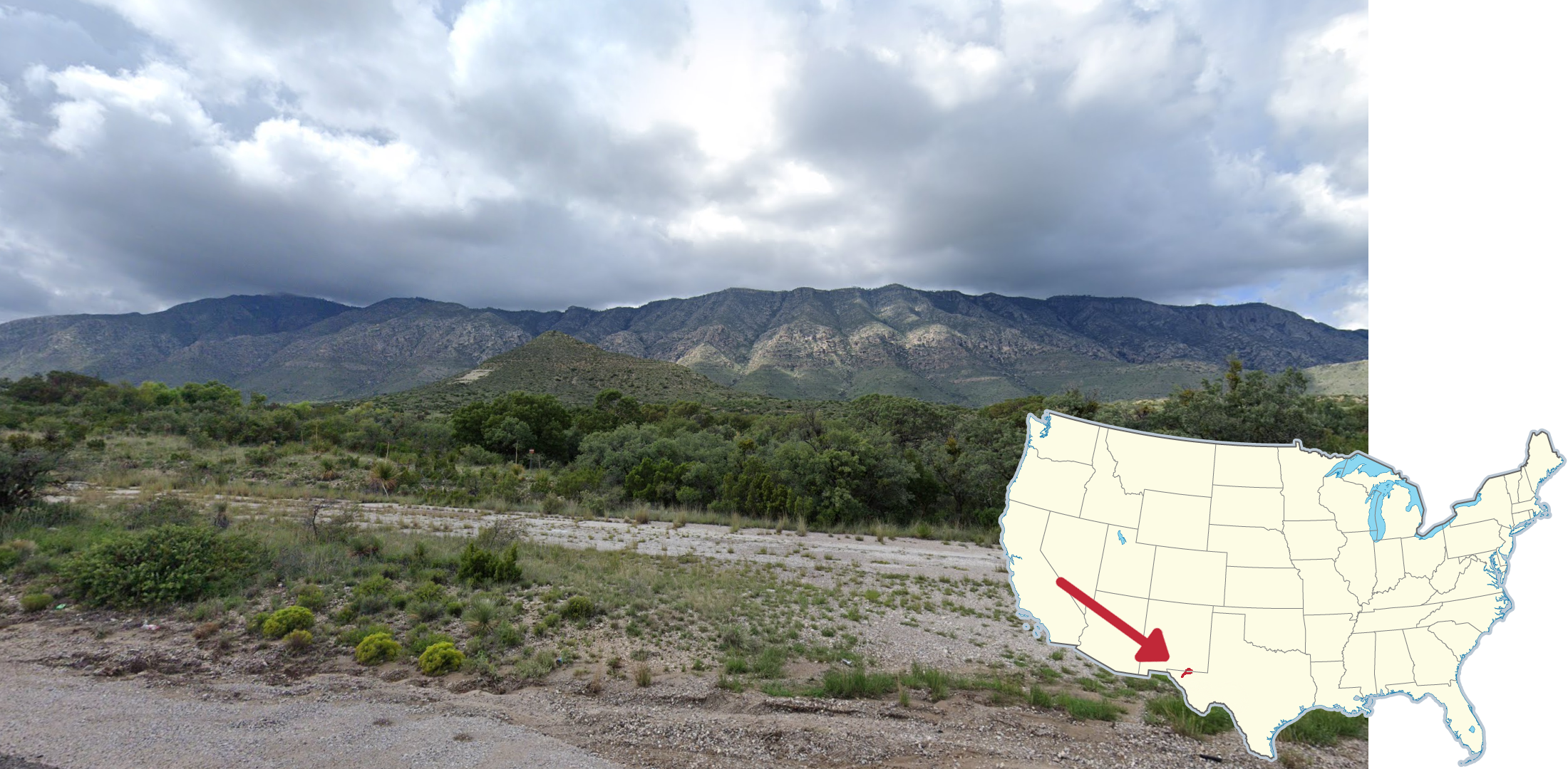
Along the New Mexico and or Texas border there is a ridge of tall, dry peaks known as the Guadalupe Mountains. In adjacent areas of both states, smaller foothills of these mountains can be seen with relatively flat tops and shrubby foliage.
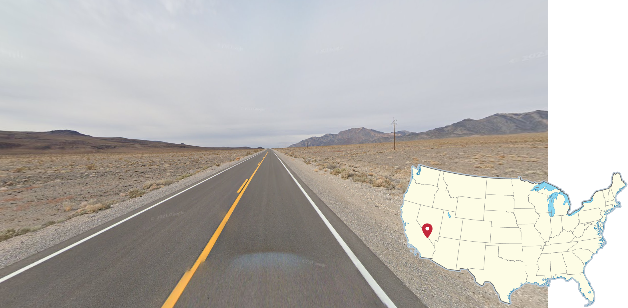
Death Valley National Park can be easily recognized by the dry, sandy, treeless mountains that can be seen from the roads that go through the park. In Generation 3 coverage, the sky can look particularly dusty.
NOTE: Many smaller roads in Death Valley only have Generation 1 coverage.
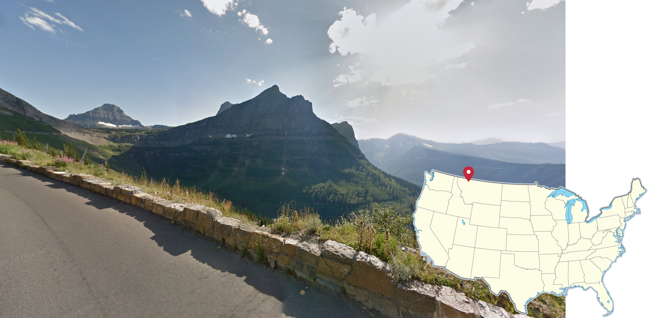
Along the Canadian border in Montana lies Glacier National Park. It is easily recognizable by its extremely tall and steep mountain peaks. Most coverage is also hazy and taken during summer.
NOTE: Other National Parks within the Rocky Mountain range of the US can have a similar appearance, so consider other clues before guessing.
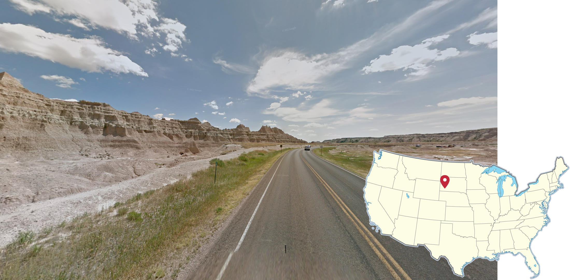
Badlands National Park features these distinct, sand-brown, eroded rock formations. The formations may sometimes appear more rounded, and lighter in colour.
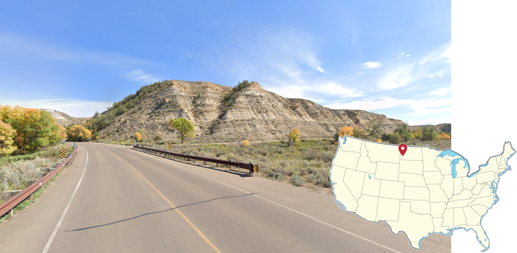
Theodore Roosevelt National Park features similar, sand-brown, eroded rock formations to Badlands National Park. The rock formations in this park tend to have more trees on them. Additionally, almost all coverage has fall colours visible.
NOTE: Similar formations can be seen in far eastern Montana as well
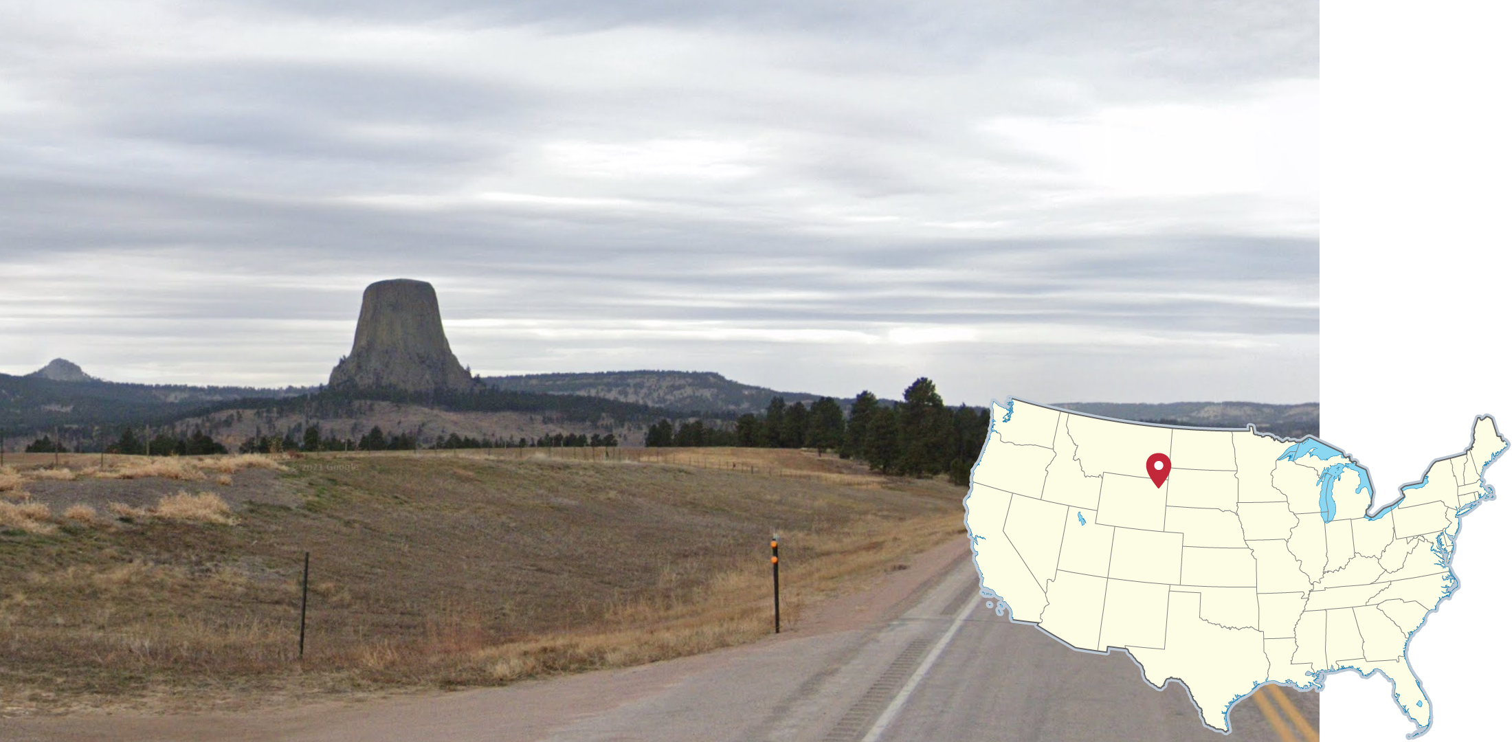
In far Northeastern Wyoming lies Devil’s Tower, which is a very tall, standalone butte protruding from the surrounding land. This can sometimes be seen from many miles away because of the lack of nearby mountains.
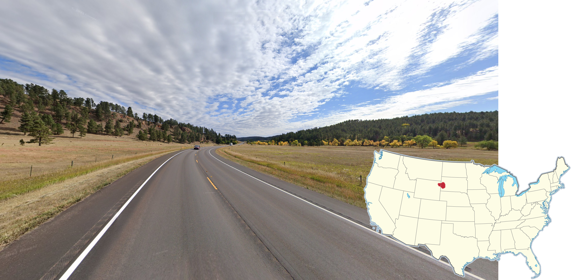
The Black Hills, located in far Western South Dakota and far Eastern Wyoming, are a series of moderately tall mountains with large amounts of conifer trees and rocky outcroppings. The surrounding areas are typically much flatter with lesser tree cover.
NOTE: This area has a similar appearance to many areas within the Rocky Mountains, which lie further to the West.
GeoGuessr’s own official maps are not very good, for a variety of reasons. Plonk It recommends you play these maps instead:
An Arbitrary United States - (map link) - 85k+ arbitrarily generated locations with a well-balanced distribution. Not pinpointable. This map is used for the Plonk It US state streaks leaderboard.
A Community USA - (map link) - This map contains over 50,000 hand-picked locations from the USA Geo Discord. Recommended for more casual playstyles.
In addition, here are some resources to help you practise the United States:
Plonk It United States - (map link) - This map contains locations for practising each meta in the Plonk It United States guide from step 2 to 3.
US Highway State Shields Quiz - (quiz link) - A quiz to help you learn the unique US State Shields.
USA Geo Discord - (Discord link) - An invite link to the USA GeoGuessr Discord.