

United States of America
NOTE: This guide will be split into three separate pages due to its length. You can use the buttons at the top of the page for each subheading or the buttons at the bottom of the page to navigate through the pages. Furthermore, this guide will only cover the contiguous United States, as there are separate guides covering Alaska, Hawaii and other overseas territories. These guides can all be found here.

Step 1.1 - US-specific

The US uses American English spelling (e.g. center, color).
In addition, the US primarily uses the imperial system for measurements. For example, speed and distance are measured in miles. You will also often see feet and inches on signs, indicating the height of bridges.
NOTE: This is useful to distinguish between the English-speaking parts of Canada, where British English spelling and (usually) the metric system are used. For example, Canada measures speed in kilometres.

Generation 2 coverage is rare in the US. If you have a Generation 2 location in a North American setting, you are more likely to be in Canada.
The exception to this is Alaska, and to a lesser extent Hawaii, which have a fair amount of Generation 2. You can also rarely see generation 2 in rural areas of the deep south.

Road signs in the US tend to use more words compared to their Canadian counterparts. A good example are railway crossing signs, which feature the literal words ‘railway crossing’ on them. In Canada, these signs are typically blank.
This tendency is also noticeable on yellow diamond warning signs. In Canada, the words will usually be on a rectangular sign below the yellow diamond, which would have a diagram on it instead.

The US uses the phrase ‘Speed Limit’ on their speed signs.
The numbers on American speed signs are usually lower than that of Canada’s, since they use miles instead of kilometres. In addition, speed limits ending in 5 are more common in the US.
NOTE: Canada uses the word ‘Maximum’ on their speed signs.

Triangular yellow signs with the phrase ‘No Passing Zone’ are exclusive to the US.

American yield signs are shaped like an upside down triangle with a red border, with a white field with the word ‘YIELD’.
NOTE: Canadian yield signs look similar, but lack the ‘YIELD’ text.

American one-way signs are usually a horizontal black rectangle with a white arrow inside of it. These signs will also always have the words ‘ONE WAY’ printed on them. In cities, they are a white vertical rectangle with the words ‘ONE WAY’ on them and an arrow underneath.
NOTE: Canadian one-way signs are of the same shape and colour, but might not have the words ‘ONE WAY’ on them.

Parking indicator signs in the US are typically white metal signs with red, green, or black text. They may include specific information about when you can park on said road, and arrows indicating where parking is (or is not) allowed.
NOTE: Canadian parking signs use similar styles and colours, but typically are less ‘wordy,’ instead using more symbols when applicable.

Large highways in the US use large, rectangular, green metal signs with curved edges and white text to mark highway exits, distances to nearby towns, and the names of upcoming roads (mainly in cities).
NOTE: Canadian highway signs have a similar appearance, but will typically have squared edges, instead of curved edges.

Leading up to exits on large highways you commonly see large, blue rectangular signs with white text, highlighting services, such as food, lodging and petrol, that are available at the upcoming highway exit.
NOTE: Canada uses similar signs on some of their highways.

These rectangular junction signs with a single or double arrow are found in the US.
NOTE: Canada uses diamond-shaped junction signs.

White and orange fibre optic cable markers are almost unique to the US.
NOTE: On very rare occasions, they can be found in Canada.

This is an example of the most common type of orange construction barrel in the United States. They are made out of orange plastic with horizontal white stripes and a black rubber base. They are usually used to block off lanes to traffic during times of road construction.

The US uses yellow middle lines and white outer lines. Double middle lines are the most common.
On divided roads, the outer line closest to the median will be yellow, and the other lines will usually be white.
NOTE: Double middle lines are less common in Canada, but not rare – use this meta with caution. Furthermore, yellow road lines are very rare in Europe.

Interstate highways, US highways, and some state roads have rumble strips in each edge of the road; which are small indentations in the pavement perpendicular to the road. These can be located on the outside edges of the road and in between lanes on multi-lane highways.
NOTE: Rumble strips may appear in Canada, but are much more rare.

Small, rectangular manufactured homes, also known as mobile or ‘trailer’ homes, are popular in rural areas of the US. In general, mobile homes are more common in the Southeast but they can be seen anywhere in the country.
NOTE: This style of home can sometimes be seen in Canada, but to a much lesser extent.

Baptist churches are very common in the United States. Similar to mobile homes, these are more common in the Southern Plains and Southeast United States, but can be found in all 50 states.
NOTE: Baptist churches are rare in Canada.

Pictured here is a group of gas stations and convenience store chains that operate in the United States, but not in Canada. This is not a comprehensive list, but some of the most common American-only chains. Regional gas station chains are found near the end of the ‘Step 2’ section of this guide.
You can click on the image to enlarge it.
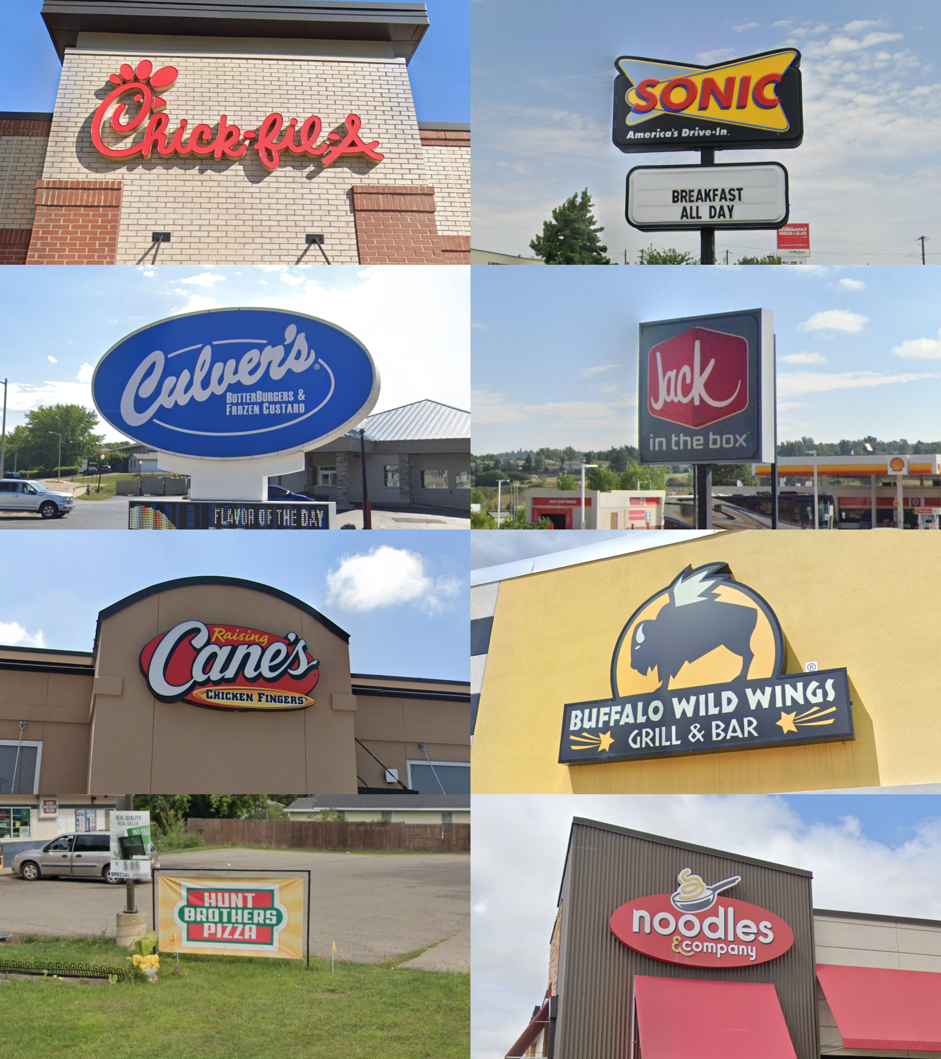
Pictured here is a group of restaurant chains that operate in the United States, but not in Canada (Chick Fil A is the only exception with a few locations in the Toronto area.) This is not a comprehensive list, but some of the most common American-only chains. Regional restaurant chains are found at the end of the ‘Step 2’ section of this guide.
You can click on the image to enlarge it.
Step 1.2 - US & Canada
The following information applies to both the US and Canada. These tips can be helpful for beginning players who struggle with distinguishing North America from Europe (and other places), especially in low-info rounds.

In the US and Canada, especially at large intersections, long metal bars with stop lights attached to them hang over the street. These bars also commonly have street signs, highway signs, or other signs attached to them.

Thin metal sign posts are common. They will typically either have several small holes or have a U-profile.

North America primarily uses wooden utility poles.
Several European countries also primarily use wooden utility poles. However, a concrete pole in particular is mostly associated with Europe.

This style of insulator, that is raised slightly on top of the utility pole, can be a good clue for the US and Canada. It is not typically found in Europe. It is especially apparent on simple poles with a single insulator.

This style of mailbox, resting on top of a post and with a small flag on the side, is mostly associated with North America.

North American semi-trucks have a longer nose, since the engine is in front of the driver’s cab. In contrast, European and Asian semi-trucks are cabovers, meaning the driver sits on top of the engine, giving the truck an L shape.
NOTE: This is only useful to differentiate between North America and Europe, as these trucks are found throughout all of the Americas. Australian and New Zealand trucks are typically a mix of the two.

Here are two common types of water towers seen in towns across the United States and Canada. They are typically very tall, and sometimes have the name of the town and state painted on them, so they can be useful for region guessing.

Generation 3 coverage in the US and Canada generally has no visible antenna. This can be helpful to distinguish it from Europe in low-info rounds. Some European Generation 3 coverage has no visible antenna, but most of it does.
There is an important exception: in national parks in the US, you can find a Generation 3 car with a stubby antenna with diagonal coils around it. Still, this specific type of antenna is not found in Europe.

Both the US and Canada also have Generation 4 “smallcam” coverage, which is mounted lower than regular Generation 4 and has a relatively big circular blur with a small protrusion at the front. The blur can also be fully transparent, making it harder to spot. When the car isn’t blurred properly, you will usually see a mirror sticking out on the right side.

Shown here is the population density of the United States. In General, areas east of the Missouri river are more densely populated than areas to the west.
You can click on the image to enlarge it.

The US, as well as most of the Americas, uses short licence plates, in contrast to longer European ones. Each US state has their own unique licence plate design. Some of these are recognizable through the blur, and are thus worth learning. Around half of the states also do not require front plates, which can also be useful in determining the state.
You can click on the image to enlarge it. Here you can also find a map showing the locations of each plate.
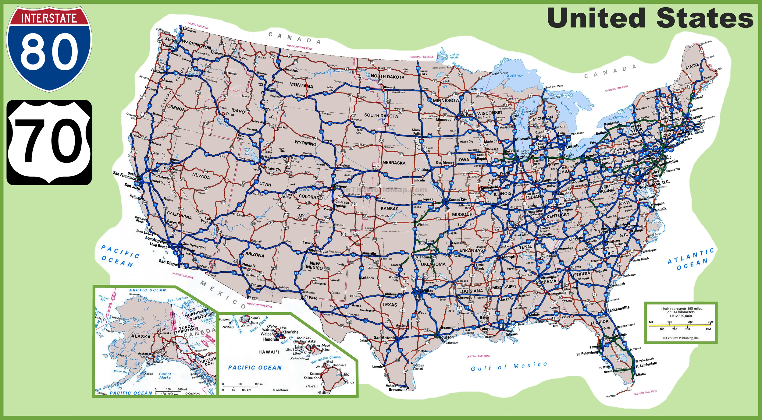
Interstate Highways are divided highways that often span large areas of the United States. Even-numbered Interstates are ordered south to north, with the lowest numbers along the Gulf Coast and Mexico border. Odd-numbered highways are ordered west to east, with the lowest numbers along the West Coast.
US Highways are also typically long roads that are sometimes (but not always) divided. The numbering system is generally the inverse of Interstate Highways, with low odd-numbered highways located along the East Coast and low even-numbered highways located close to the Canadian border in the north of the country.
NOTE: There are generally more exceptions to the US Highway numbering system than the Interstate Highway numbering system, in terms of placement.
You can click on the image to enlarge it.
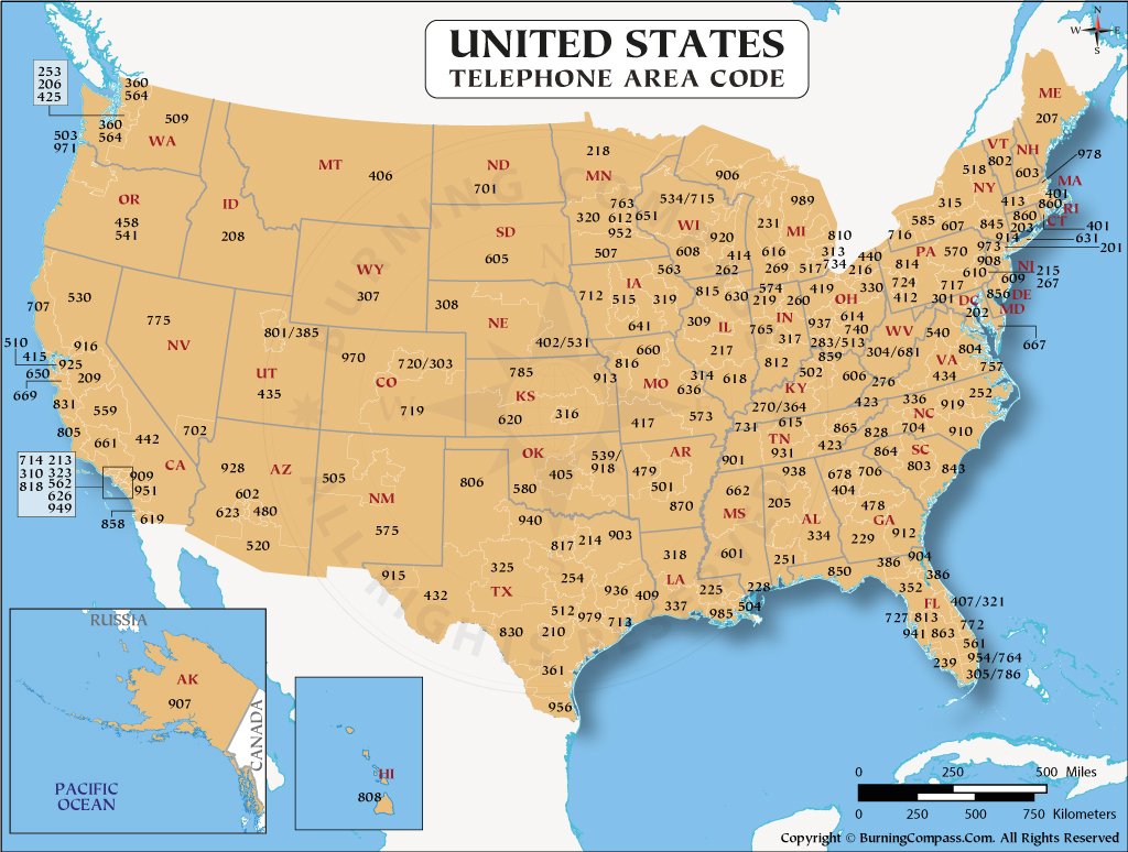
US telephone numbers start with a three-digit area code. While these area codes are not clustered by initial digits, they are useful to learn.
You can click on the image to enlarge it.

Each of the 50 states has its own state flag. These appear frequently enough that they are worth learning.
You can click on the image to enlarge it.

Shown here is a topographic map of the US.
Most significant elevation is in the west: here you will find large mountain ranges, but also more flat, high plateaus. Some parts have lower elevation: good examples are the Central Valley and Imperial Valley in California.
Elevation in the east is generally much lower. The most significant amount of elevation is found in the Appalachians, low mountain ranges running through the eastern and northeastern US. Good examples of hills in otherwise fairly flat regions are the Driftless Area in the Midwest, and The Ozarks in Missouri and Arkansas.
You can click on the image to enlarge it.

This is a forest density map of the contiguous United States. Eastern and Northern regions of the country typically have much denser tree cover than Western and Southwestern regions.
You can click on the image to enlarge it.

Corn fields can most commonly be found in these regions. For a detailed overview, see this map.

Soybeans are short, dark green crops organised in long rows and are found in similar regions where corn is grown. They are most common in the Eastern Plains, Midwest, Lower Mississippi Valley, and areas of the Mid Atlantic.

Along the Canadian border in North Dakota, and rarely Montana, fields filled with short yellow canola flowers (Brassica napus) can commonly be seen from the road.

Cotton is a crop that produces large fields of fluffy white flowers. It is most commonly produced in coastal Southeast States, the Lower Mississippi River Valley, Western Texas, and parts of California and Arizona. You can click here for a more detailed map.
NOTE: When cotton is not fully grown (earlier in the year) cotton fields often look like this.

Rice production only occurs in a few areas of the US, so it is very useful for region guessing. It is typically grown in large, flat fields that resemble low prairies. It is only grown in north-central California and the Lower Mississippi River Valley in Arkansas, Louisiana, Texas, and Mississippi. You can click here for a more detailed map.
NOTE: When rice is not fully grown, rice fields often look similar to this.

Oil pumpjacks are short, industrial-looking metal structures located at the surface of oil fields and are used to pump crude oil from the earth below. They are most common in western states, particularly in Texas, Eastern New Mexico, and North Dakota.

The Great Plains are in the middle of the United States and stretch from the Canadian border in the North, to central Texas in the South. This area is primarily flat with few trees. Some areas feature agriculture fields, while others feature dry and barren grassy fields.

The area spanning from the Montana Border with Saskatchewan to the Western Great Lakes features many ‘prairie potholes.’ These are areas of low-lying wetlands that feature marshy grasses and small, shallow ponds.

The Appalachian mountain range is a low mountain range that runs through the eastern states. The general landscape consists of low, forested mountains, with beech and oak trees being a common sight.
NOTE: Houses in the south generally have less storeys. New England architecture, commonly consisting of wood panelling, high roofs and a porch, is also more common toward the north, especially in New England.

The loblolly pine (Pinus taeda), and longleaf pine (Pinus palustris), commonly referred to as southern pines in the community, are found throughout the southeastern US. They are a great way to recognize this region, as they are abundant, recognizable and mostly limited to this part of the country. They tend to be tall, with fluffy-looking clusters of pine needles.

Many parts of the Deep South, stretching from Oklahoma to South Carolina, have reddish soil. The exact tint of the soil can range from yellow to deep red.

Grass that is used in lawns in the southern US (colloquially known as Bermuda and St. Augustine grasses) go dormant in the winter months. This causes the lawns to turn beige or light brown in winter; whereas grasses used in more northern areas of the US stay much greener in winter.

The Lower Mississippi River Valley is a very flat and open landscape with red soil in areas of Tennessee, Arkansas, Mississippi, and Northeast Louisiana. Corn and other crops are common in this area.

The area stretching from the Canadian border to Northern New Mexico is home to the Rocky Mountains. These jagged, rocky formations often feature many pine trees and visible snow all-year round at the highest peaks. Some areas of the Rocky Mountain Range are noticeably dry, with few trees.

The Great Basin, centred around Nevada, can be recognized by the tall, sometimes snow-capped mountains in the background. There are dry, but grassy, and slightly shrubby plains leading up to the mountains.
The tallest mountains are in Nevada, Utah and California. More gradual, rocky hills can be seen in Oregon, and greener mountains can be seen in Idaho and central Utah.
Keep in mind that there are exceptions, so make sure to look out for other clues before guessing.

Great Basin Sagebrush (Artemisia tridentata) is a short, shrubby blue-green bush that is common in the interior western United States.It is most common in arid areas.
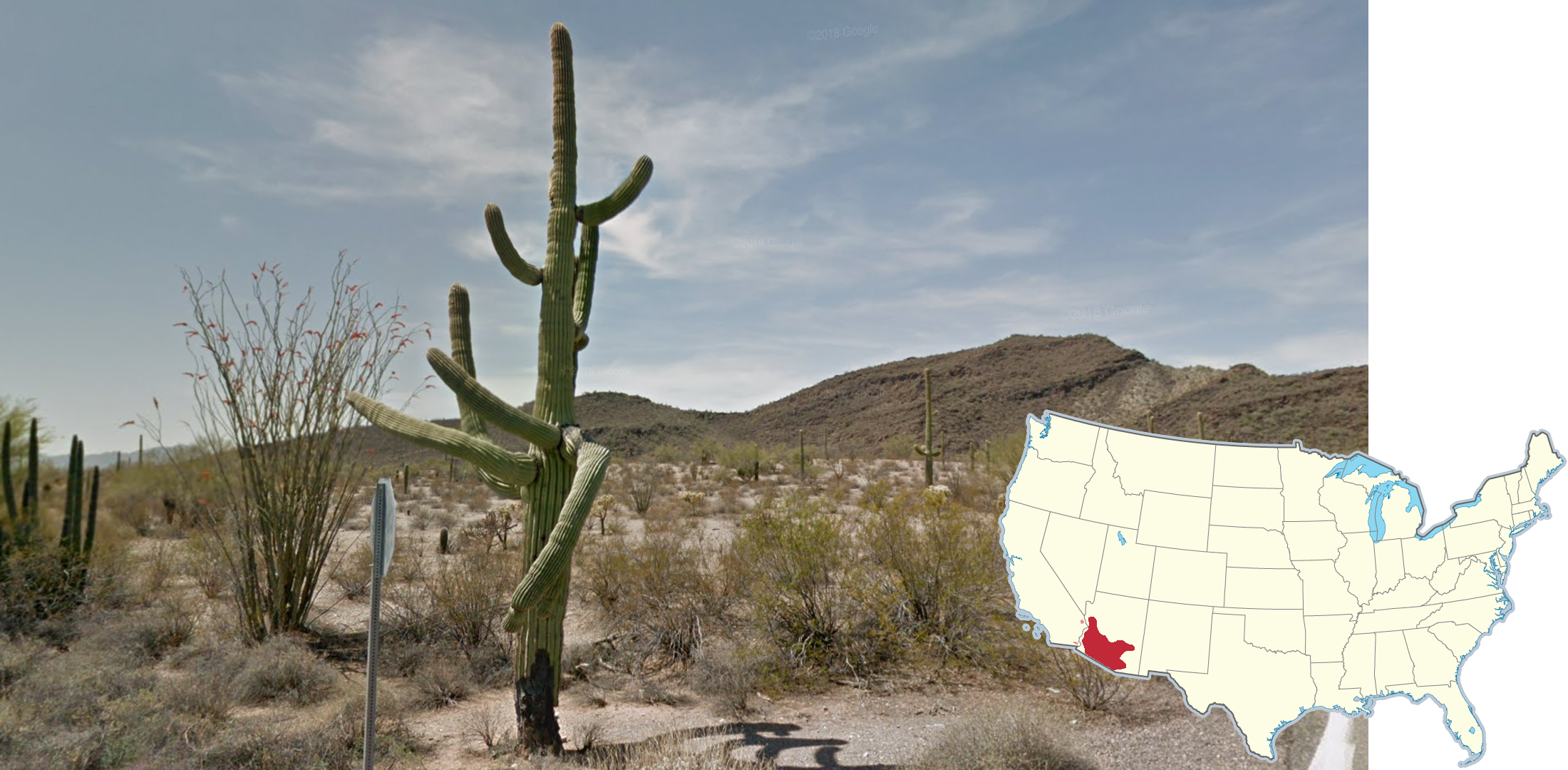
Saguaro cacti are most commonly shaped like tall, straight tubes with several branches extending from the main tube. They are most commonly found in southern Arizona, on the Sonoran border.
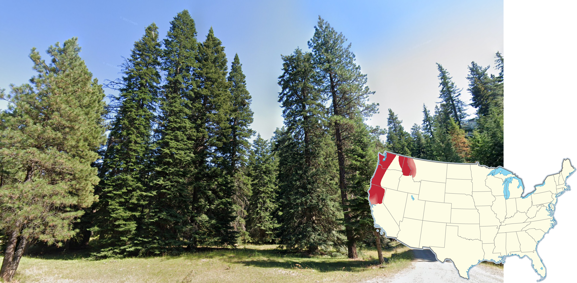
Extremely tall conifer trees (Douglas firs) with a dark brown bark, and dark green leaves, can most commonly be seen in Cascadia. Notably, they can also be found in northern California, Idaho and as far east as Montana.
Beware that they are also commonly found in British Columbia.

Temperate rainforests are found in coastal areas of Washington, Oregon, and Northern California. These rainforests feature many broadleaf trees, large conifers, and ferns.
NOTE: These rainforests stretch north into coastal British Columbia and Southeast Alaska as well.

The Southwest, centred around the Four Corners region of Utah, Arizona, New Mexico, and Colorado, feature many mesas and tablelands. Often, these rock formations will be red in colour. Additionally, red soil is common in these areas.

Palm trees are common in coastal areas of the Southeastern states, as well as the Desert Southwest region. Shown here is the Mexican Fan Palm, which is most common in California and along the Gulf Coast, but other palm tree types have a similar range.

Just west of the metropolitan areas of Austin and San Antonio Texas lies a large area of dry, rocky hills featuring many yucca and prickly pear plants. Texas Live Oak trees are the predominant tree type in this area.
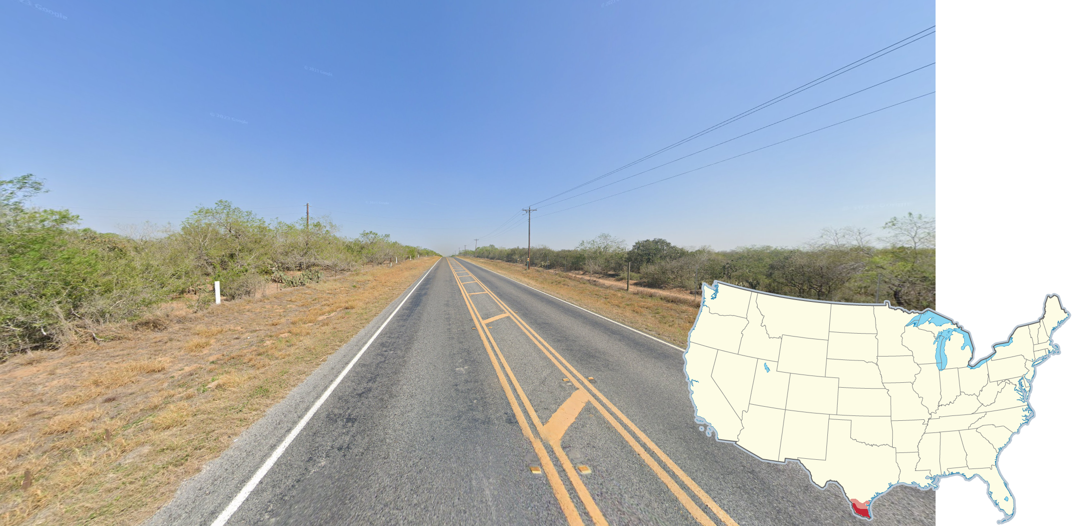
The Rio Grande Valley in South Texas is extremely flat and features shrubby trees and agricultural fields. This area borders the Mexican state of Tamaulipas.

Spanish moss, appearing as greyish white drapes, can sometimes be seen on trees in the deep south.

Agricultural golden fields can commonly be seen in eastern Washington.
NOTE: Flat areas of northern and eastern Oregon can have a similar appearance.
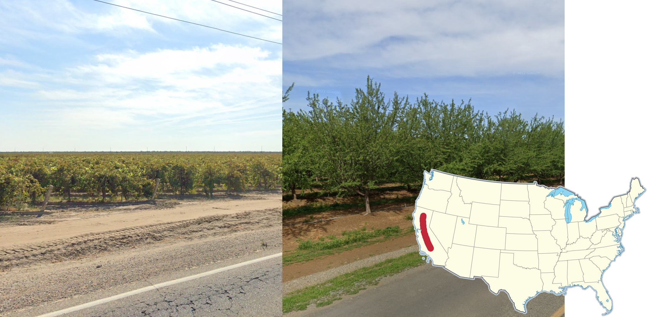
Central Valley, California can be recognized by its Mediterranean climate. This is reflected in its agriculture, seen in the vineyards and olive trees that can commonly be found here.
In addition, rolling hills can be seen toward the edges of the valley.

The Nebraska Sandhills are a recognizable region of rolling hills covered with prairie grass in the central-north part of the state.

In the Appalachian area stretching from southern New York to southern Virginia, there are a lot of forest-covered rolling hills, with flat valleys dividing them. A majority of the ridges are oriented Southwest to Northeast.
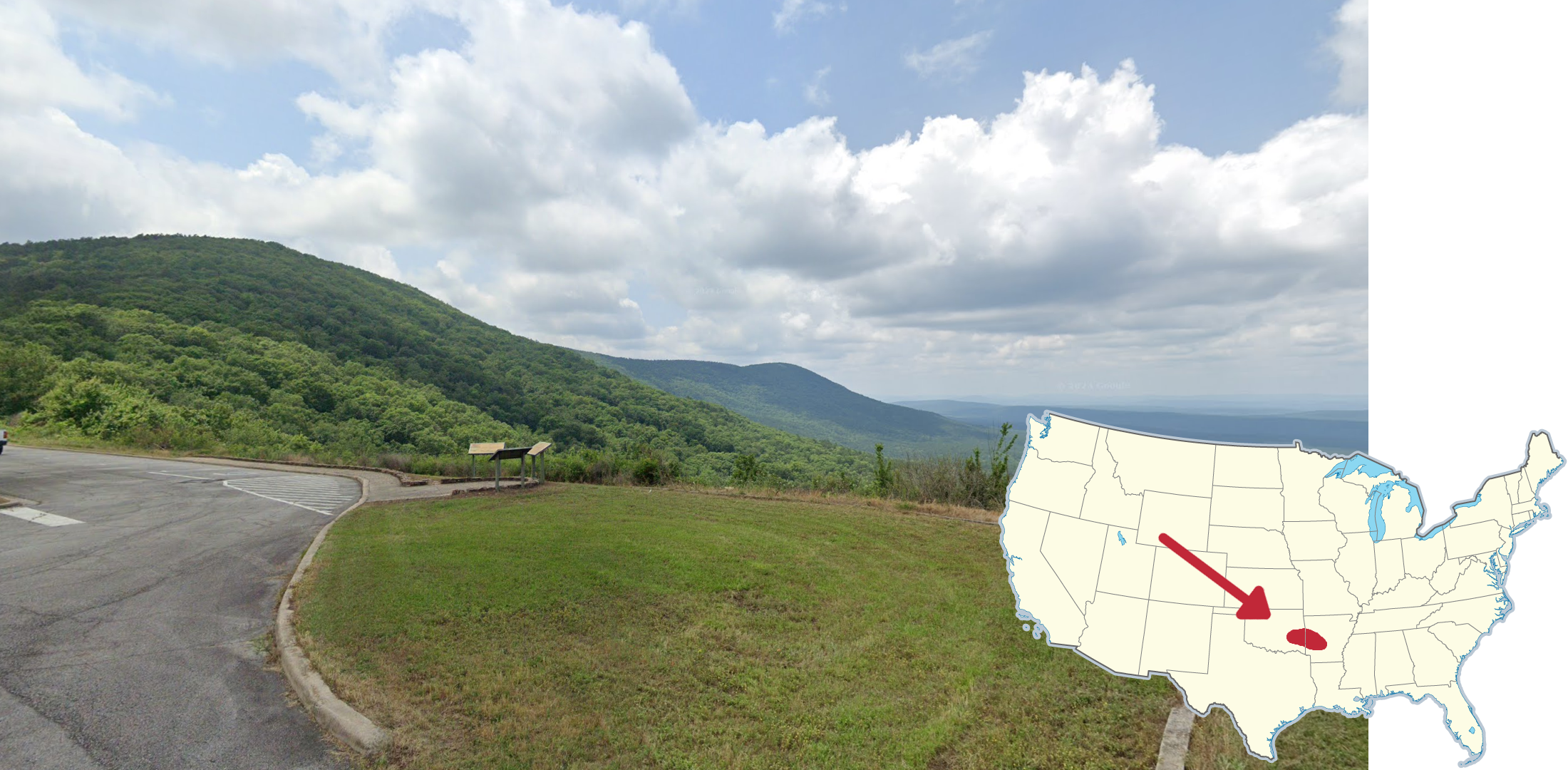
The Ouachita Mountains stretch from Eastern Oklahoma into West-Central Arkansas. Unlike the nearby Ozark Mountains, these mountains are typically more steep in nature and easier to see from a distance.