
Montenegro


Montenegro uses the standard European plate with a blue strip, and the Montenegro coat of arms on a red circle. The red circle is visible through the blur.
NOTE: The white section of Albanian licence plates do not have a red circle.

Montenegro is a small, mountainous country. Inland mountains are lush and green, while most coastal mountains have distinct exposed, light coloured rock. Most roads are also only 1 or 2 lanes wide.

The most common bollard is white with a red reflector on the front and a white one on the back. The bollard also has a black top.
NOTE: These bollards are also found in Slovenia.
Montenegro uses black on white or red on yellow chevrons.
NOTE: Albania uses white on black chevrons.

Guardrails in Montenegro are often rusted.

Montenegro is the only Balkan country where you’ll commonly see both A-type and B-type guardrails.
NOTE: For a good overview of European guardrails, see this infographic.

Montenegro uses simple round concrete or wooden poles.

‘Rifts’ can commonly be seen in Montenegrin coverage, due to poor stitching.
NOTE: Rifts are also common in Albania, and can rarely be seen in various other countries.

Coverage in Montenegro is limited to main roads, with very few minor roads covered. The only main road not covered is the A1, south of Kolasin.

This map shows the distribution of where rifts are found. Although rifts are common in Montenegro, coastal rounds will not have rifts. By the coast, there will be a short antenna with no rifts. There will be a long antenna with rifts inland.
You can click on the image to enlarge it.

Green, agricultural valleys with deforested hills to make way for farmland are most commonly seen in the north.

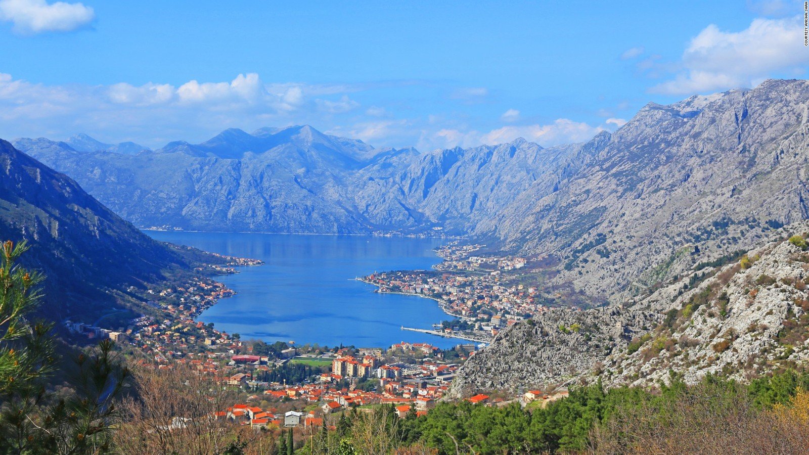
The Bay of Kotor has a touristy and populated feel to it, with many people dressed in swimwear. A distinct steep, rocky ridge can also be seen.

Dry mountains with a lack of trees are seen around Podgorica, and to the south of it. Vineyards are also commonly seen in this region.

Pine forests can be found in the north and a small area north of Nikšić, but most commonly in the east.

Durmitor National Park can be recognized by a distinct landscape consisting of grassy, treeless mountains with a high-altitude feel.
The town of Žabljak is situated in this national park, and can be recognized by the landscape but also by the unique architecture.

Podgorica is the capital and largest city in Montenegro, and can be recognized by the modern buildings, wide roads and modern infrastructure.

These distinct staircase-like mountainsides can be seen in the Cemi River Valley.

Many small islands can be seen within Slansko Lake.

The Pljevlja Coal Mine can be recognized by the wide, artificial wall of gravel. The mine can often be seen from afar.

The Google Car can be seen chasing this police car on the P15, between Lovcen National Park and Čevo.

The southern part of the E80, between Orahovo and Đurmani, can be recognized by the yellow outer lines.

The Skadar Lake Bridge can be recognized by the railway and stone bollards next to the road.
GeoGuessr’s own official maps are not very good, for a variety of reasons. Plonk It recommends you play these maps instead:
AI gen - Montenegro (map link) - A balanced map of Montenegro with over 10,000 locations.