
Madeira


Since Madeira is an autonomous region of Portugal, you will often come across various types of Portuguese infrastructure, such as poles and chevrons.

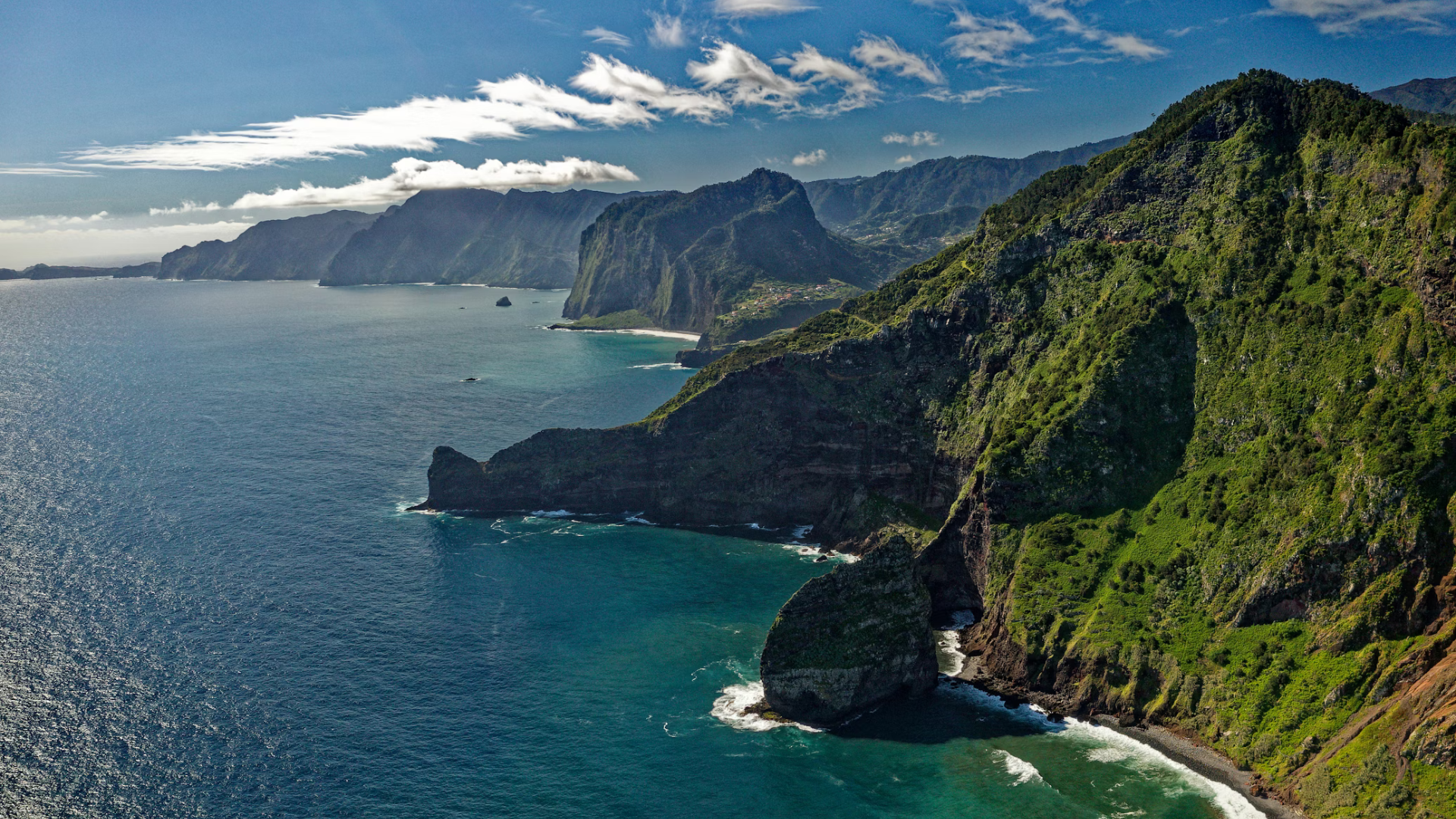
Madeira is a very mountainous and semi-tropical island.
NOTE: The Azores are less mountainous and more temperate.

Similar to continental Portugal, Madeira has a lot of eucalyptus forests, which can sometimes look deceptively like the mainland.
NOTE: The Azores do not commonly have eucalypti.

Hydrangeas can occasionally be seen.
NOTE: They are even more common on the Azores.

African lilies (Agapanthus praecox) are very common in Madeira. They can be recognized by their long grassy leaves and round flower clusters at the end of a long stem. The most common colours are white and blue.

Due to the lack of flat terrain, terrace farming is extensively practised on the island. Stone walls are used to separate the individual plateaus.

Ferns are very common throughout the island.

Houses are mainly painted white, grey, or pastel colours such as yellow and pink. In addition, the red tile roofs will often be in a good condition.

Concrete block barriers, usually painted white, are often found along roads.

Bus stops signs on Madeira follow a unique black, white and yellow colour scheme.

Taxis on Madeira are yellow with a blue stripe running along the sides of the car.

Madeira commonly uses small and unique stone bollards with a red reflector. They are either cuboidal or cylindrical in shape.

Madeira sometimes uses yellow-and black guardrails on its mountain roads.

These speed limit signs are unique to Madeira and can be found on its highways.
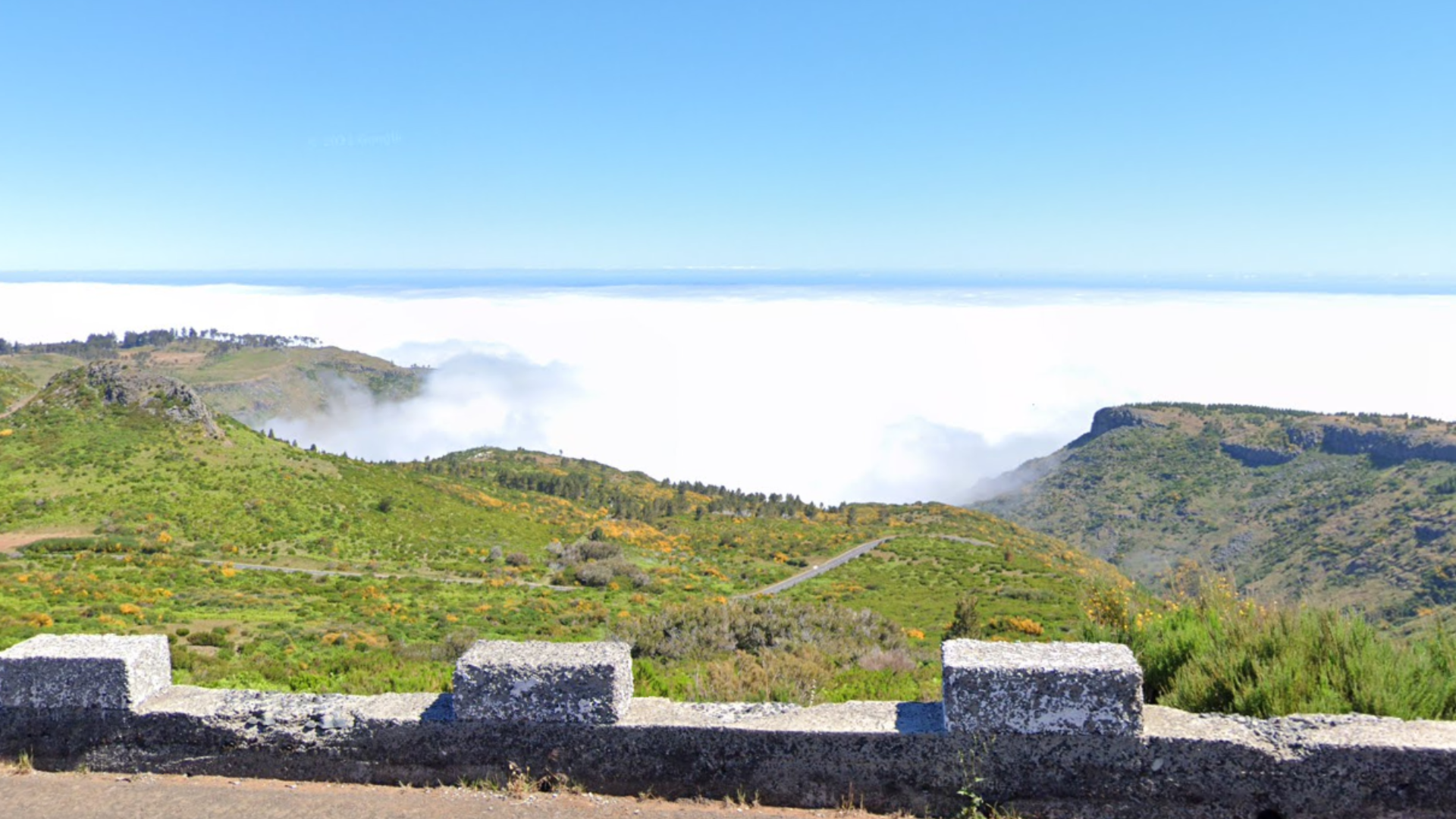
Low altitude clouds are typical on the island, and are often seen on street view.

Foggy coverage is quite common.

As a result of the island’s mountainous terrain, tunnels are very common.

On bridges you will often find railings painted dark green.

Signposts on Madeira are often striped.
NOTE: These are also seen on the Azores.

You can sometimes find free roaming cows on high-altitude roads on the island, as well as warning signs for those cows. The cows will typically be brown with white spots, contrary to the Azores, where the cows will typically be black and white.
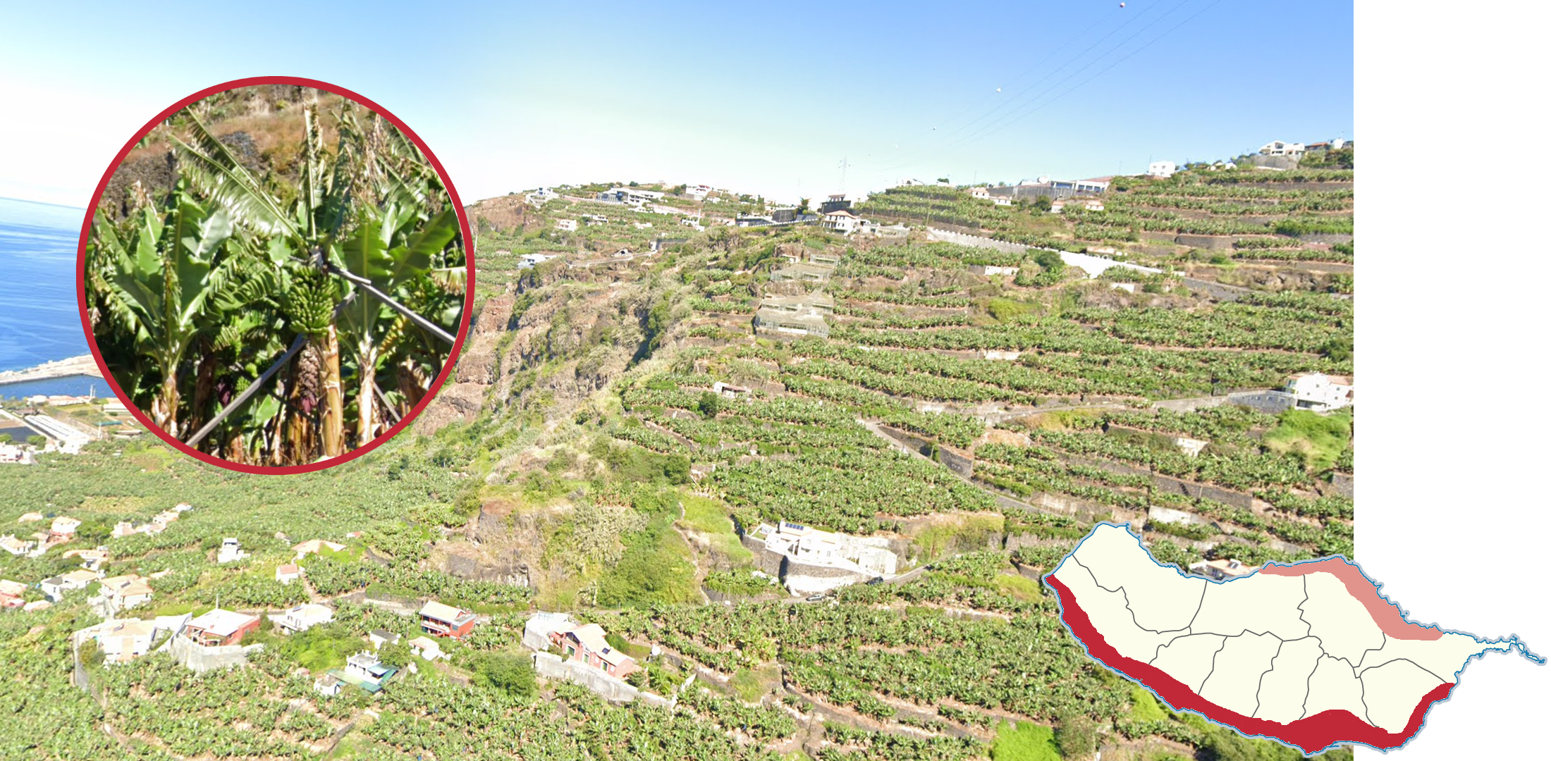
The majority of banana plantations are found in the south.

The centre-west of the island is home to an elevated plateau. It can be recognized by the unusual flatness, misty coverage, and the presence of wind turbines.

The road east of the plateau can be recognized by its unique mountain formations and the black-and-yellow guardrail on the side of the road.
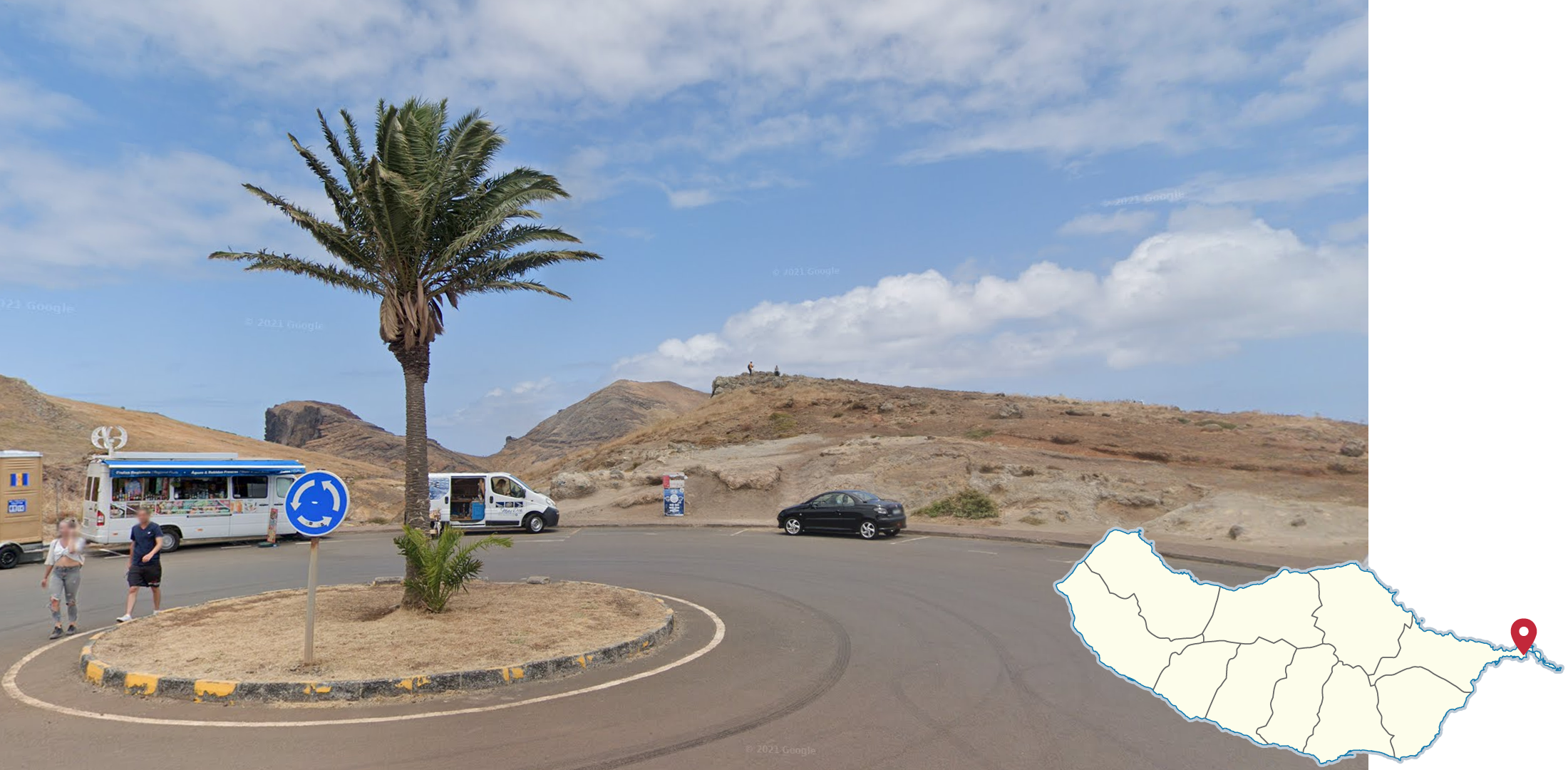
The eastern tip of the island is very arid with little to no vegetation.

The ER211 can be recognized by the dark pavement combined with its exposed brownish soil.

Pico Areeiro is the second highest mountain on the island, and the highest with coverage. It can be recognized by its view over most of the island, and the white radar station at the top.

The Penha d'Águia is located in northeastern Madeira, isolated on an elevated hill.

The Cristiano Ronaldo International Airport is located in eastern Madeira. The north of it is built on these numerous concrete pillars.

Cascata dos Anjos is situated in the southwest and is a popular location on the island. It is a 100-metre-high waterfall, which cascades onto the road below.

The islands of Ribeira de Janela, located in the northwest, are a famous photographer spot with their vertical, jagged shape.

These dark, sharp rock formations with an island in the background are found in Porto Moniz in the northwest.