
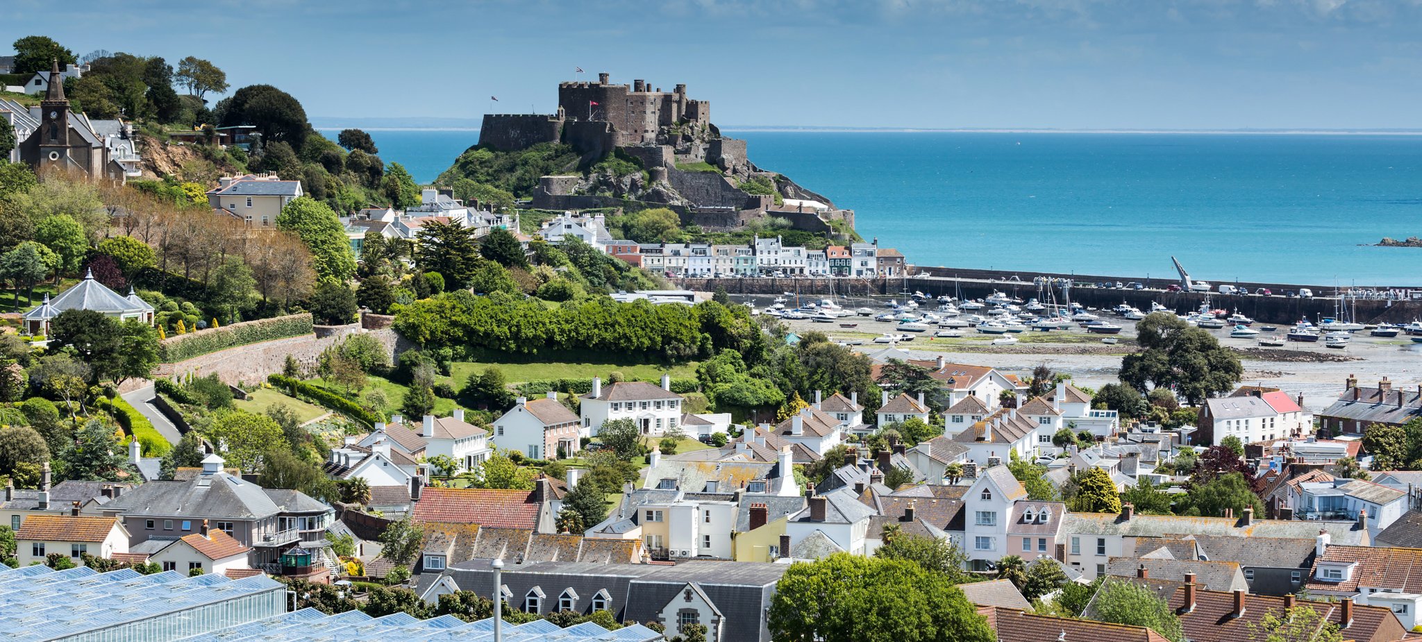
Jersey


Jersey is a self-governing island territory in the Channel Islands, located off France’s northwestern coast. It is a British Crown Dependency, so for country streaks purposes it is counted as part of the United Kingdom.

The island is shaped by a unique mix of British and Norman influences. The many winding roads and hedgerows are reminiscent of English country lanes, with tree-covered roads being particularly common. However, due to Jersey’s unique geographical position, most coverage features sunny weather.
All images were taken by a Generation 2 camera.

Jersey licence plates follow the British model, having a long white front and yellow rear plate. In addition, you will notice the island’s red coat of arms on the left, as well as the letter ‘J’ at the beginning of all codes in unblurred plates.
NOTE: In contrast to the British mainland, Jersey was never a member of the European Union. This means that local plates do not have a blue strip.

In general, road infrastructure is similar to that found in the United Kingdom. This includes driving on the left, as well as directional signs, chevrons and warning signs. Some of the subtle differences are discussed below.


Similarly, the local architecture shares many characteristics with that of northern France. This includes pastel-coloured walls and dark slate roofs. However, British-style terraced houses are also common.

Jersey is home to large reserves of red granite. As a result, it is a popular building material used for the construction of many walls and houses throughout the island.

In contrast to the iconic red booths found on the mainland of the UK, telephone booths in Jersey are uniquely yellow.

Cornish palms (Cordyline australis) can be identified by their distinctive thin trunks and arching leaves. They are commonly used as decorative plants on Jersey.
NOTE: These palms can also be found on some stretches of the British mainland’s coastline.

Jersey uses yellow give-way lines at intersections.
NOTE: In contrast, the UK typically uses double dotted white lines for this purpose.

Jersey has an extensive network of cycling routes. Most notably, you will find signs referencing the start or end of a “Green Lane”. Blue route markers, containing a map of the island in the centre, are also common.

Some road signs are asymmetrically attached to their signposts. This appears to be more prevalent on Jersey than on the British mainland.
NOTE: Keep in mind that this only applies to a minority of signs. Most are attached regularly.

Most street name signs in Jersey are adorned with the coat of arms of the parish in which they are located.
You can click on the graphic to enlarge it.

Contrasting with the island’s typically rural look, the area surrounding the capital city of St Helier is more urbanised, featuring taller buildings, narrower streets and a more lively atmosphere.
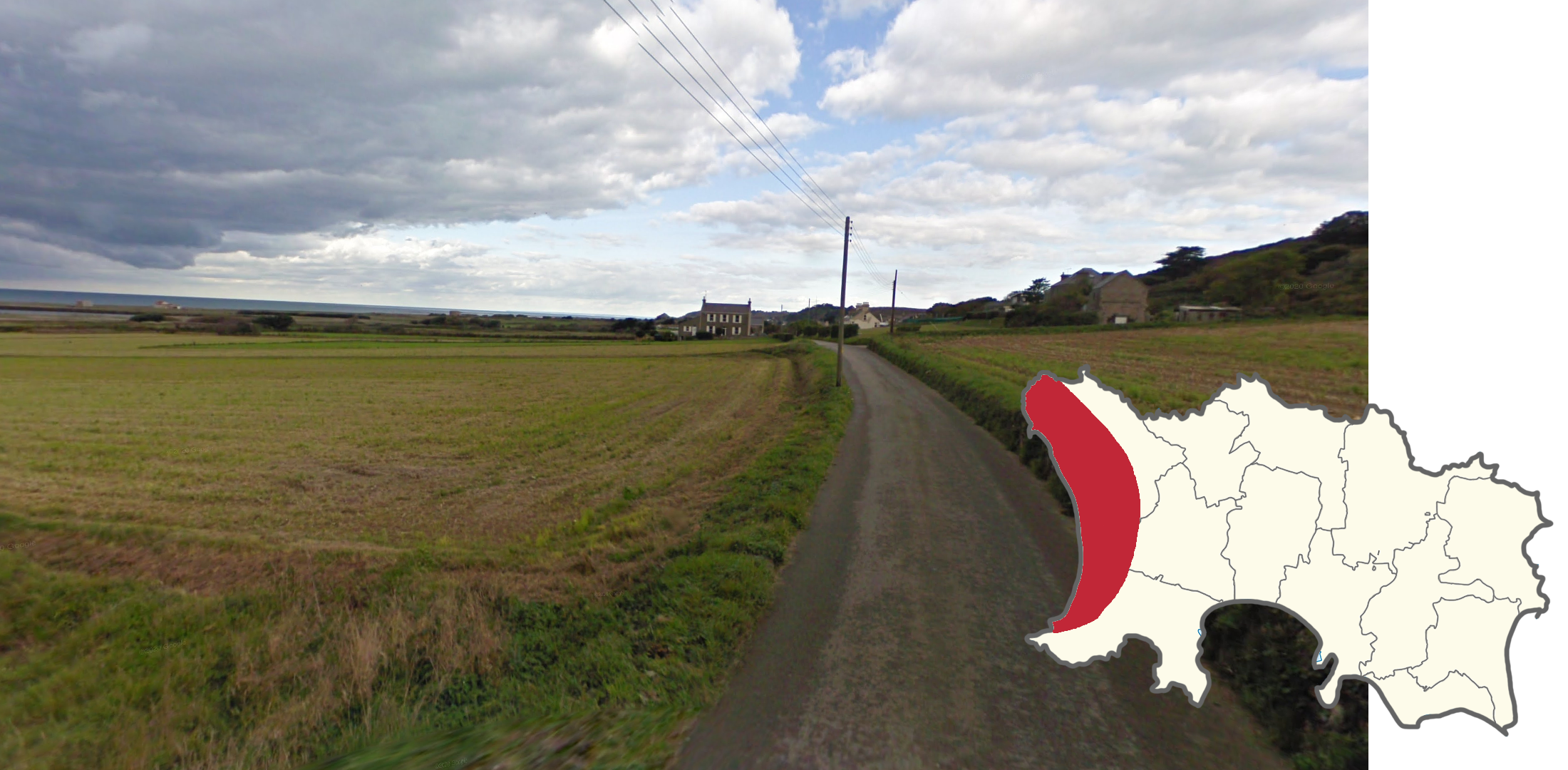
The Les Mielles Nature Reserve is a vast, treeless expanse located on Jersey’s western coast. Combined with the gentle westward slope and partially overcast coverage, this makes for a very recognisable area.

Imagery containing a greenish-purple discolouration can be found in the southwest of the island.
NOTE: This glitch typically makes parts of the screen appear darker than they actually are. In addition, it blends into the landscape more seamlessly than other glitches.
Moreover, this glitch is not unique to Jersey. It can be found in other countries as well.

The roads surrounding Jersey Airport can be recognized thanks to the visible boundary fence.

The La Collette Power Station is located on a peninsula south of the capital. Its chimney can be seen from various points along the south coast and serves as a useful reference point for pinpointing.

Victoria Ave runs along the island’s southern coast, immediately west of St Helier. It is the only divided road on Jersey and features a distinct maroon median.